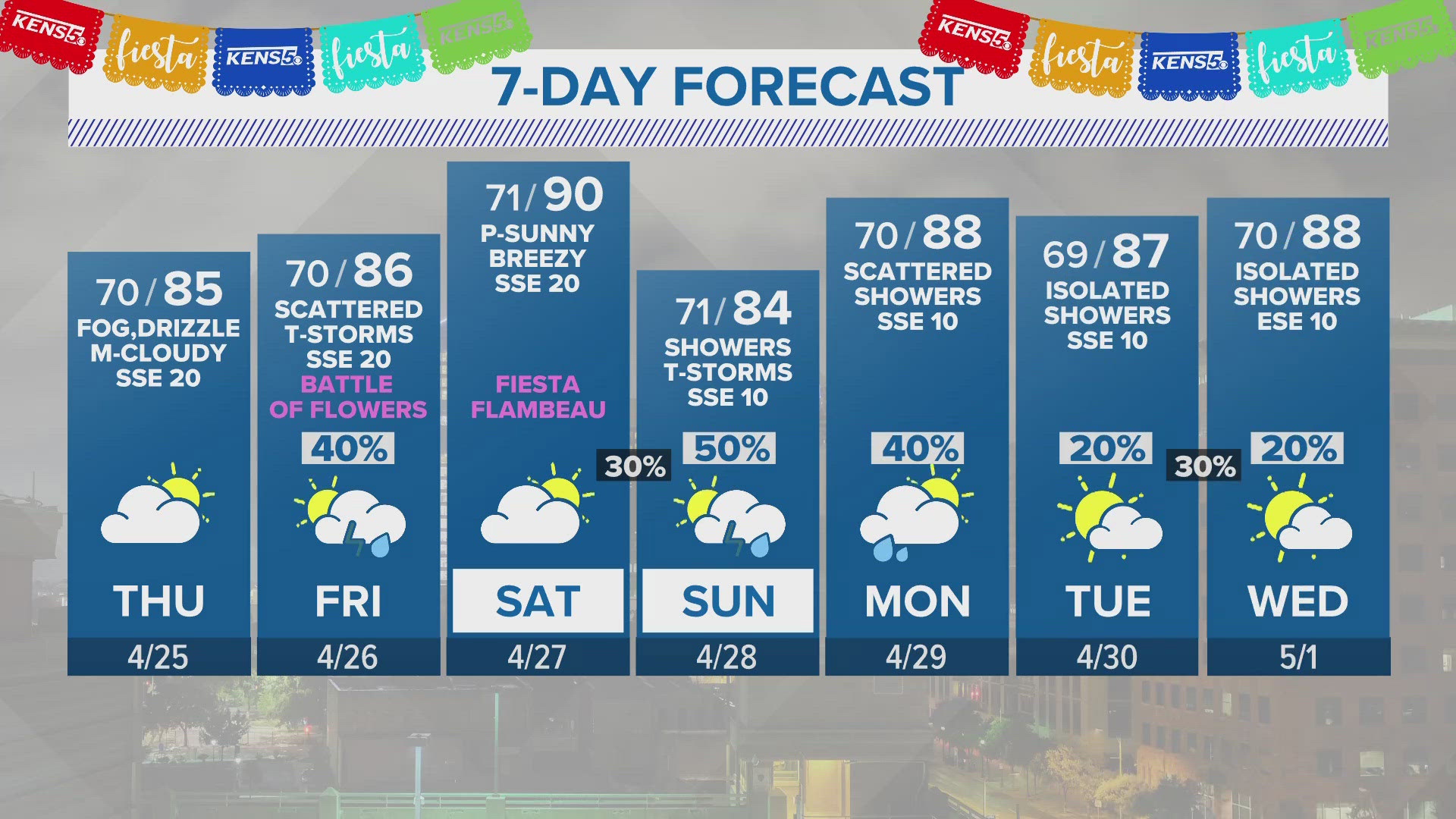

SAN ANTONIO — Potentially severe weather will begin moving through South Texas Tuesday night, setting up for a Wednesday that will likely feature heavy rain.
According to the National Weather Service, a Severe Thunderstorm Watch is in effect for Val Verde County through 11 p.m. Tuesday.
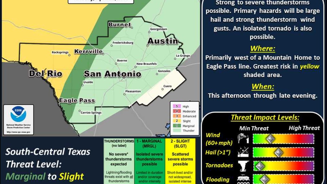
For Wednesday, Flash Flood Watch will be in effect from 7 a.m. through midnight Thursday for Gillespie, Llano, Burnet, Blanco, Hays, Travis, and Williamson Counties. San Antonio can still expect about an inch of rain, and the slight risk of severe storms for Wednesday evening covers the region. There is a slight risk of golf ball-sized hail and damaging winds. Isolated tornadoes can't be ruled out.
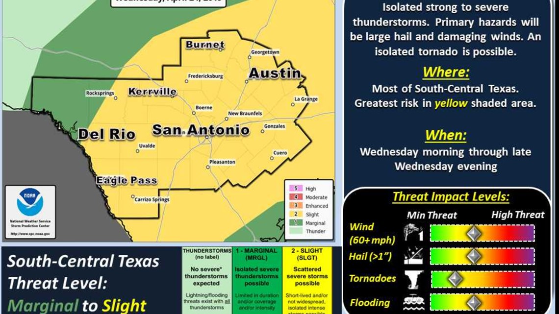
The National Weather Service said the system will move from the west to the east, reaching the Hill Country Wednesday morning after spending Tuesday night in the Rio Grande area. The I-35 corridor will feel the storm Wednesday evening.
Rainfall totals should be less than an inch for areas south of US Highway 90. 1 to 2 inches are possible along and north of Del Rio to San Antonio to La Grange line. Widespread 2 to 4 inches of rain are possible across the Flash Flood Watch area, with isolated pockets up to 6 inches possible.