
Just last weekend 40,000 San Antonians hit the street running, walking, biking, and skating in the newly-created Siclovia. Once rated by Mens Fitness as one of the fattest cities in America -- we are determined not to let that ever happen again.
One way we can keep that resolution is to explore the extensive greenway hike-and-bike trails that are easily accessible to all parts of the city. They are masterpieces of integration, restoring natural areas, utilizing organic features and creating a systemof interconnecting trails that provide invigorating inspiration for exploration.
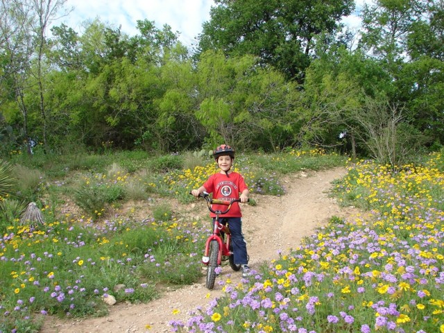
One really terrific feature of these greenway trails is that, with very, very few exceptions, they will keep you off the roadway and on a wide and protective paved path. That's a real plus when you are taking wee ones along for the ride.
Spring is here and the buds are popping. It's a great time to find out first-hand what's going on along our city trails.
Mission Reach - South:
So far, this sunny section of hike and bike trails begins at Blue Star inthe King William neighborhoodand goes on for a bit over 2 miles to Mission Road. Along the way you'll come across some whimsical local artist features and fun historical and educational signage that explains the ecosystem restoration. Find out about: embayments, weirs, and riffles, then you and your kids will be able to point them out , and more importantly, understand the role they play for aquatic wildlife.
The next 6-mile stretch is still fenced in, but not for long.
Steven Schauer with the San Antonio River Authority says they expect to open this portion of the river trails some time this summer. It will be worth the wait once it is open. They removed one of the river-side roads and widened the river, and are adapting river features to make it more accessible to kayakers.
This also opens up more options for bikers, making Mission San Jose and Mission San Juan more accessible without having to go to the street level. Look for major changes in the Mission San Juan area, in particular. The drainage-ditch look has been removed and instead, the river will be restored as it originally flowed when the area was inhabited by Spanish missionaries and colonists in the 1700s. To do this they had to move a lot of earth, including the area around the Making Hay sculptures.
The National Park Service project is being interwoven with the SARA project, Schauer says. They will have demonstration farming using the San Juan Acequia. Schauer says it will all look significantly different.
And something we've been waiting for: According to Schauer, there is potential for possible concessions for renting bikes, canoes, kayaks and maybe even food. Right now, there are a few water fountains and restrooms at some of the street connections and at adjacent parks.
If you take the trail now, you'll see the Mission Concepcion Athletic Complex being built along the east side of the river. The Bexar County venue tax project will house indoor volleyball courts, a gymnasium, 6 basketball courts that can be converted to volleyball courts, softball and baseball fields, and a lighted track.
It's the largest array of indoor volleyball courts in this part of Texas, Schauer said.
The grand opening for the complex, which will be operated by the Archdiocese, is scheduled for June 6.
The section of the trail from Mission Road to the Espada Park area near SE Military should be open by Labor Day.
Ready to explore the Mission Reach right now? SARA has a downloadable self-guided tour with descriptions and highlights of 15 sites along the route. This includes the wonderful, and somewhat hidden Yturri-Edmunds House, managed by the San Antonio Conservation Society.
The final section of the Mission Reach is expected to be opened by the end of 2013.
Salado Creek Greenway South:
Off Binz-Engleman Road, the connection from Jack White Park, passing next to Pletz County Park, through the Willow Springs Golf Course and on to Covington Park is about ready. The ribbon-cutting for this shady stretch is scheduled for March 24.
Parks staff are in discussions with officials at Fort Sam to connect the the Salado Creek Greenway North, out of Tobin Trailhead/John James Park to the south at Jack White. But that is just in the preliminary stages.
Leon Creek Greenway - Northwest:
Feel like a full workout? Starting at the Valero Trailhead at Loop 1604 and I-10, next to the Drury Inn, you can hike and bike for 13 miles along the Leon Creek Greenway. Passing through fields, bridges, wooded areas, winding paths, near ponds, and over creek-beds, this adventure will keep you entertained for hours.
You'll also pass through several parks including: Oxbow and OP Schnabel Park. A recent bike ride took us as far as the VIA station on Ingram Road. Boy Scouts have put in some benches along the route and there is a picnic table at Grissom Road, but Parks staff say they endeavor to keep the trail as natural as possible and encourage people to make use of boulders as sit-upons.
The last leg of this trail is pretty new witha nice jaunt through woods and rocky outcroppings. We like to take a break by exiting at Bandera Road for lunch.
Leon Creek Greenway - West:Under construction right now is the 2.6 mile section of trail off Old Hwy. 90 from Rodriguez County Park to Levi Strauss Park. Look for the loop trail that goes along Leon Creek and up through a wooded area. The park has several soccer fields and fitness equipment at the Enrique Barrera Center.
WEST - In Progress:
Also on the drawing board is the $10.1 million Westside Creeks Restoration Project in the central part of the city, including hike and bike trails connecting the Beacon Hill, Donaldson Terrace, Woodlawn Lake areas to the San Antonio River downtown. Project manager Rudy Farias says there are about 20 different organizations representing neighborhood associations as well as civic and cultural groups and schools who are giving input into the project. There are still several bureaucratic hurdles to go through by Farias says everyone is pretty hyped up to get this going along San Pedro Creek, Alazan, Apache Creek, , Martinez, Comanche Creek and Woodlawn Lake. Getting rid of unsightly drainage ditches and making attractive trails will definitely encourage recreational mobility, and also beautify the city. (Just think of the difference it has made in the Museum Reach area.)
Medina River Greenway - South:
Medina River Greenway System includes a wonderful 7-mile paved trail that begins at the Medina River Natural Area on Hwy. 16 South. (You can also find parking further South on Applewhite Road.) There are several challenging switchbacks here, and nice wooded trails along this serene route. There are 6 additional miles under construction that should be open in a couple of years.
Hardberger Park - North:
Hardberger Park on NW Military Hwy. is an awesome place to hang out. It has a couple of basketball courts, a commendable 1.5-acre dog park, an engaging playscape, picnic tables, a shady 1.27-mile loop trail and a 2.7-acre oak savanna restoration project. A 2.6-mile, mostly flat,trail connects the Salado Creek Greenway from Blanco to Huebner. (They also have an picturesque dairy barn being restored as a working farm for educational purposes. - Fun!)
TxDOT is working hard on the Wurzbach Parkway and part of that construction includes plans for hike and bike trails there.
The connection between Walker Ranch Parkand McAllister Park should happen by 2014.
Salado Creek Greenway - Northeast:
Beginning at McAllister Park on Jones Maltsberger Road, this hike and bike trail (there is a separate trail that winds through the park) begins at the dog park and takes you across Wetmore Road and over an amazing above ground wetland boardwalk through to Lady Bird Johnson Park and on to Los Patios before passing under Loop 410 to the Tobin Park Trailhead.
If you are not too sweaty, stop in for brunch at Los Patios. Weather permitting, you can sit out on the patio.
Tobin will take you to the Oakwell Trailhead and past the Oakwell Equestrian Center and eventually will lead south to Jack White Park. There are no new additions to this trail, but that boardwalk, with its regular thunka-thunk-thunk is so rewarding that you'll keep coming back.
_________
Another great resource for inspiration are the City of San Antonio downtown bike ride maps available online.