
SAN ANTONIO — It turns out Memorial Day weekend may have just been the primer for a scorching start to June in South Texas.
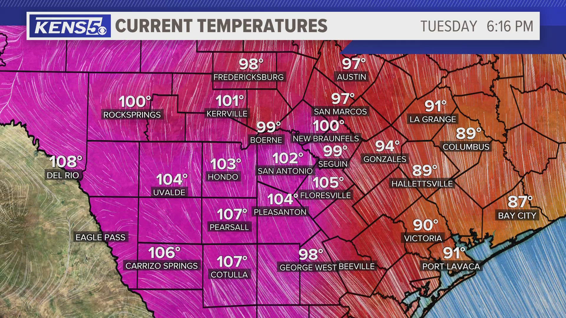
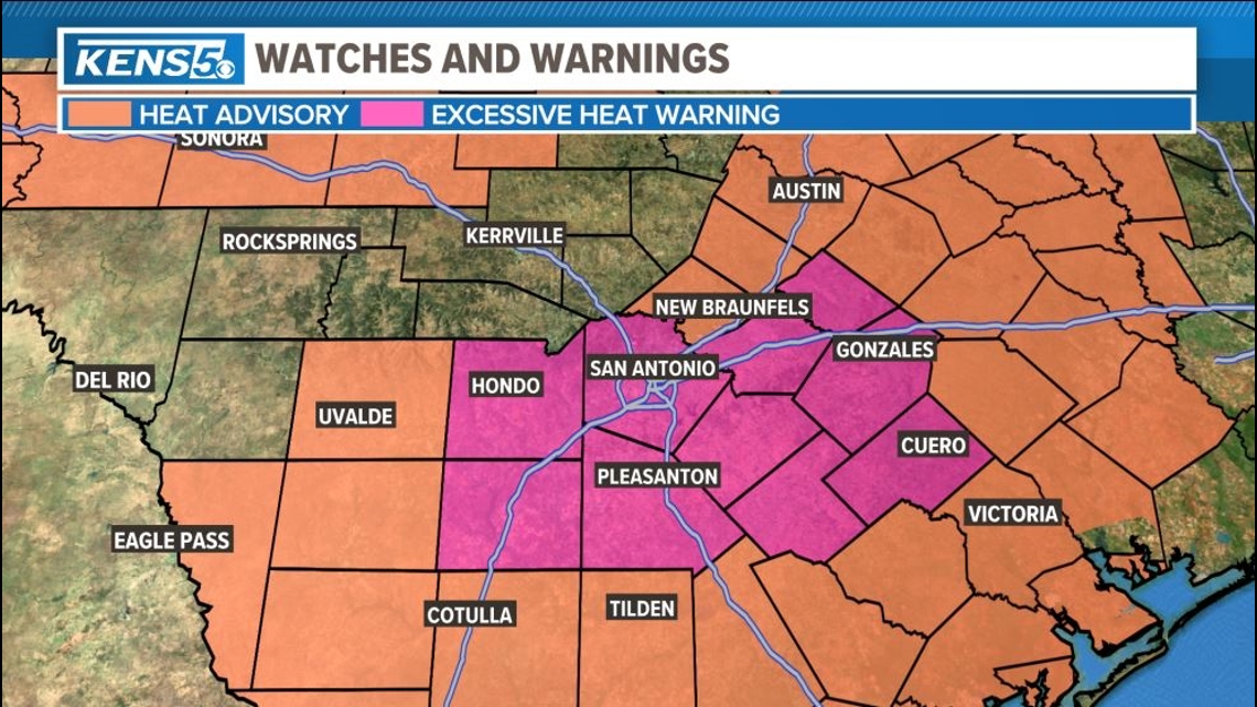
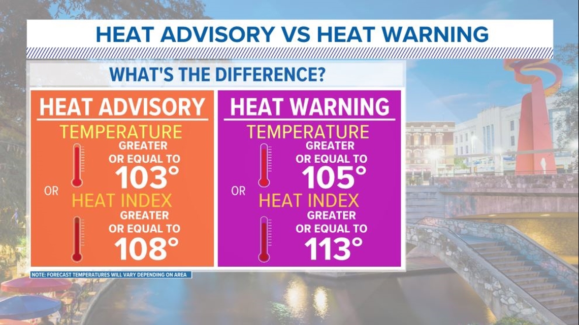
An Excessive Heat Warning issued Tuesday afternoon for San Antonio and surrounding communities has expired, but the above-average heat will persist for a few more days at least. On a day when the average high historically is 91 degrees, the mercury shot all the way to 103 in the afternoon—breaking a 1916 record by two degrees.
Heat indices, or "feels-like" temperatures, reached 112 in San Antonio. They got up to 117 in George West and Beeville.
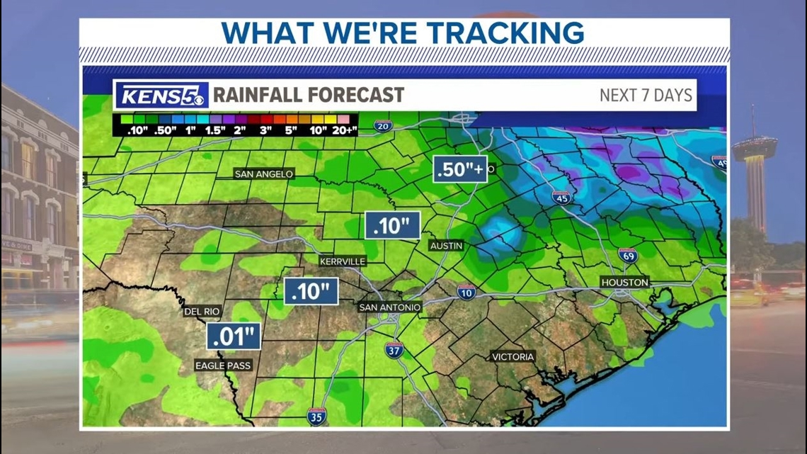
High temperatures are scraping triple-digits the rest of this week, too, in a time of the year when it's supposed to top out at 92 or 93. Rain chances, meanwhile, will be virtually non-existent.


The warming trend offers a scorching weather sequel to last June, when San Antonio reached 98 degrees or higher a whopping 16 times in 30 days, including three straight days of record-breaking 105-degree heat. We're already ahead of schedule in 2024, having hit 100 degrees for the first time on May 25—a month ahead of San Antonio's typical first 100-degree day of the year.
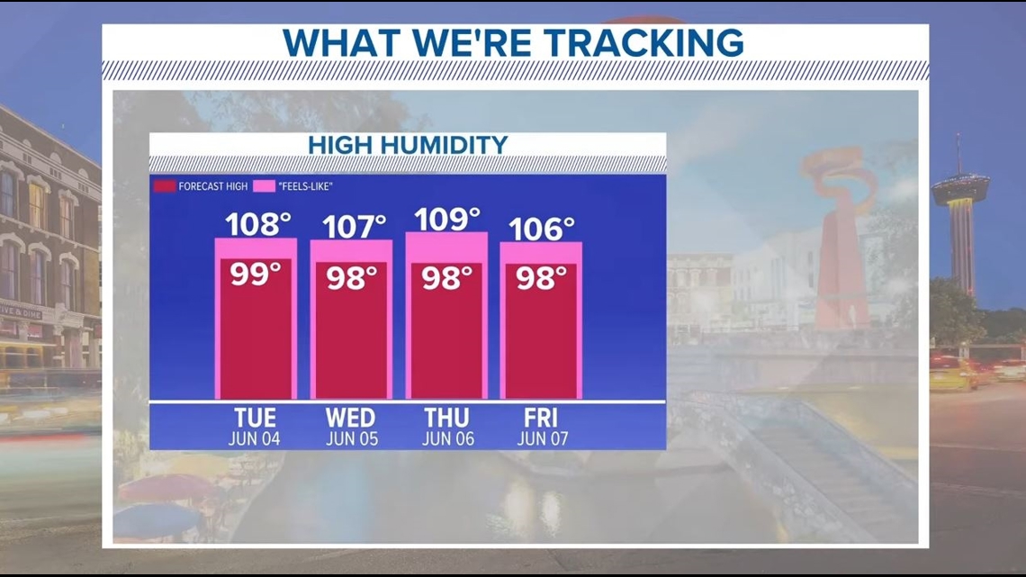
High humidity levels are making it feel like it's over 100 degrees, exacerbating the extreme heat risk. What's more: Nights and mornings aren't providing much relief. Daily lows this week will be in the mid-to-upper-70s when we historically get down to 71 or 72 overnight. In short, keep that water bottle handy, your attire light and any strenuous outdoor work at a minimum.


As hot as it'll feel, we shouldn't break any records this week so long as we stay under 100 degrees. Read on for more on what to expect each day of this heat wave in San Antonio, and stay updated on KENS5.com/weather.
Tuesday: High of 99, low of 78. Head indices, or "feels-like" temperatures, could reach 111 thanks to high humidity levels. Light wind gusts of five to 10 mph could provide some relief. It'll be mostly cloudy overhead.
Wednesday: High of 98, low of 77. There is a low chance (20%) of precipitation in the evening heading into the early hours of Thursday morning. It'll start off mostly cloudy before turning sunnier as the day goes on. Heat indices could reach 111.
Thursday: High of 99, low of 76. Expect fog in the early morning before conditions clear. Wind gusts of up to 10 mph could provide mild relief.
Friday: High of 97, low of 75. Sunny skies and clear conditions, with more light wind.
Saturday: High of 98, low of 76. It'll be sunny all weekend.
Sunday: High of 99, low of 77.
>MORE LOCAL NEWS:
>TRENDING ON KENS 5 YOUTUBE: