SAN ANTONIO — Weather changes are on the way San Antonians and they will bring thunderstorm activity with a slight risk for hail and strong winds this evening. A line of showers and storms will develop ahead of a cold front this evening followed by windy conditions Saturday.
San Antonio is at a level 2 of 5 for severe storms with hazards including small hail, strong winds and isolated tornadoes possible this evening. The line of storms will first develop in the Hill Country and move towards San Antonio by late around 7 p.m. The primary time for storms to arrive in San Antonio are around Friday at 7 p.m. to Saturday at 4 a.m.
Here's an hour-by-hour forecast:
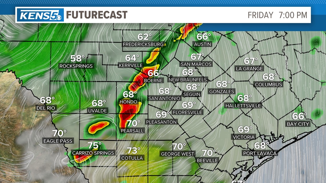
Friday at 7 p.m.


Small pockets of heavier rain will pop-up west of San Antonio with showers and storms developing near Boerne. San Antonio will still be under cloudy skies with temperatures in the upper 60s.
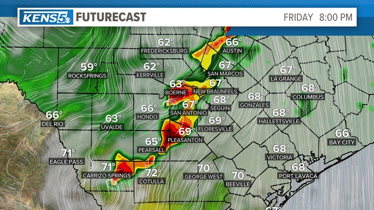
Friday at 8 a.m.


A line of storms will become more developed with some isolated pockets producing heavy rain. At this time showers and storms will develop in the San Antonio area with the chance for heavier rain to fall on the northwest side of Bexar County. Some storms may produce thunder and lightning. Remember "when thunder roars go indoors."
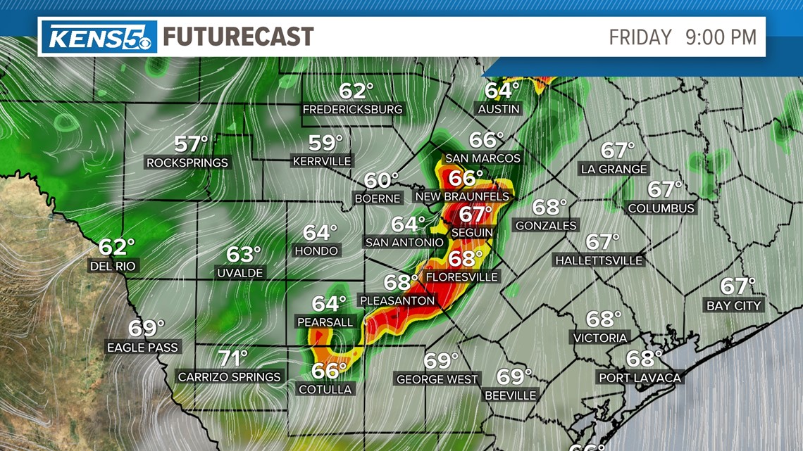
Friday at 9 p.m.


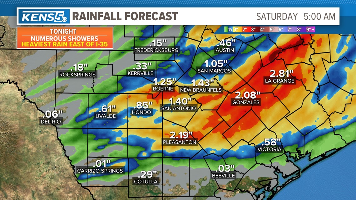
These line of storms will move fast and move out of Bexar County by 9 p.m. and will bring windy conditions behind it. The rain won't last long in San Antonio but could bring an inch of rain to some parts of the area. Heavier rain will be measured near Gonzales and other cities east of San Antonio.


Weekend: Very windy conditions will develop Saturday evening with wind gusts around 40 mph. A cold front will also push through Saturday dropping temperatures slightly in the mid 60s. Overall plenty of sun will be around for the weekend. Enjoy!


