
WASHINGTON D.C., DC — Hurricane Beryl has set new records as only the second named storm of the 2024 hurricane season. Beryl is the earliest Category 5 hurricane to form in a season, and has already caused damage and killed multiple people in the southeast Caribbean.
During Tuesday's 5 p.m. update by the National Hurricane Center, Beryl downgraded to a Category 4 storm.
Communities and meteorologists all along Beryl's projected path are making preparations and studying the hurricane to determine where it may end up and at what strength, but they are not the only ones.
The National Aeronautics and Space Administration (NASA) partners with the National Oceanic and Atmospheric Administration (NOAA) to observe and study hurricanes from space using both satellites and the International Space Station (ISS), according to NASA.
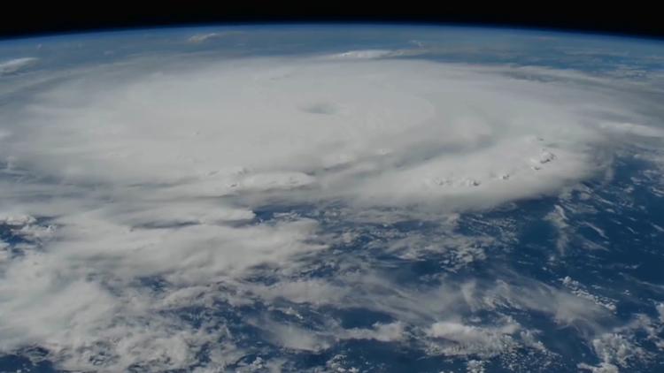
The ISS recently shared a video of Hurricane Beryl from orbit, capturing the swirling storm in the Atlantic Ocean at the beginning of July.
Story continues below
According to NASA, the ISS vantage point helps scientists understand how climate change impacts hurricanes and helps them to learn how communities can better prepare for tropical cyclones.
NASA's TROPICS mission reportedly collects and analyzes data from four satellites to help research what causes certain storms to rapidly intensify.
According to NASA, four identical CubeSats, small, cube-shaped satellites about the size of large soda bottles, pass over the Earth's tropical regions in a low orbit, which allows them to study a given storm about once an hour.
These satellites reportedly give NASA more data to understand how storms evolve over time, which can help to better forecast severe weather in the future.
More information on the TROPICS mission can be found at this link.
There are multiple models showing possible paths that Beryl could take, depending on various factors. For more on these factors, and the possibility of whether or not Beryl could reach Texas, visit this link.
More stories from 6 News: