SAN ANTONIO — A cold front is lurking over North Texas and will eventually drift south over South Texas Wednesday afternoon, bringing in cooler temperatures just in time for Halloween.
Spooky weather returns Tuesday with showers and a few thunderstorms possible. Eerie weather that brings rain and cloud cover, will linger Tuesday night through Thursday morning along the cold front.
Strong to severe thunderstorms are possible Tuesday and Wednesday. Stronger thunderstorms could produce intense wind gusts and large hail. Most of us under a level 1 "Marginal Risk" both days.


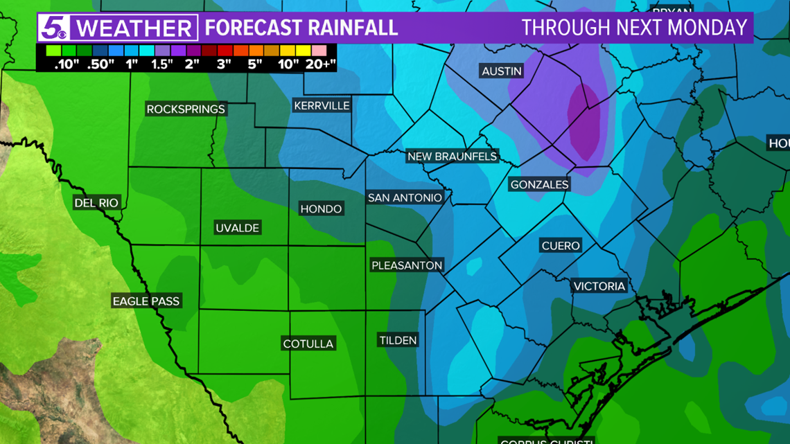
Most of us will receive half an inch or less Tuesday through early Thursday morning. Northern counties and the Hill Country could see up to an inch and a half of much-needed rainfall, since drought conditions are still considered an issue for the region.


Rain should end well before trick-or-treating, but a few clouds will stick around Thursday night.
RELATED:
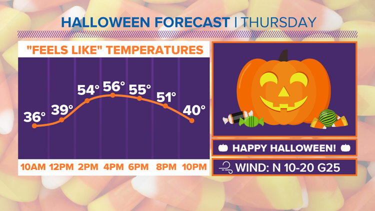
Hang on to your witch hats and masks! Howling wind is likely for Halloween night with wind gusts up to 25 mph. A breezy north wind will make it feel much cooler. A wind chill in the upper 30s is likely early afternoon.


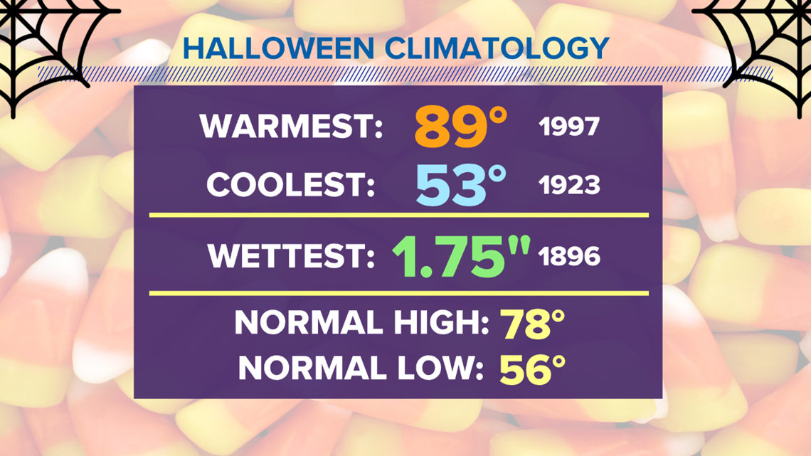
We will only be a few degrees away from our coolest Halloween on record in San Antonio. We have a forecast high of 56 degrees, which is only three degrees away from our record coolest.


So dress for cold weather this Thursday night and make sure you have the Halloween decorations secured as the cooler weather moves in and the strong wind passes through.
Don't forget you can download the KENS 5 app for the latest news and weather information each day while you are on the go.
PEOPLE ARE ALSO READING:


