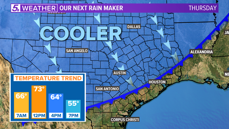
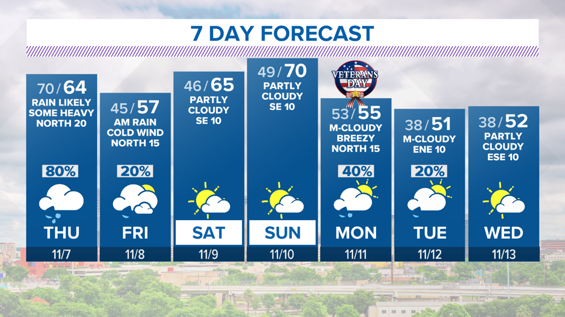
SAN ANTONIO — A cold front approaching our area will nudge showers and thunderstorms into South Texas Thursday afternoon. The threat for severe weather will remain very low for San Antonio, but some thunderstorms may produce gusty winds and frequent lightning.
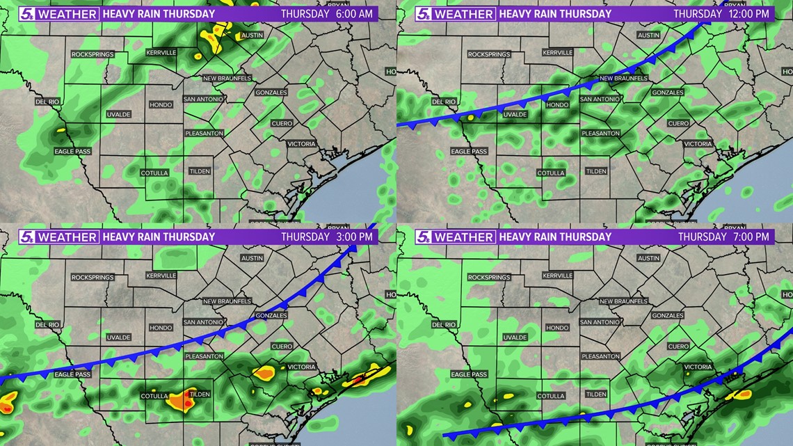
Make sure to keep the umbrella handy! Pockets of heavy rain should begin to move in after noon on Thursday.
Here's the expecting rain timing:

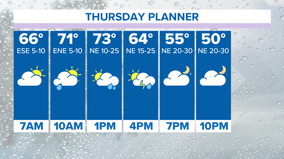
Temperatures will also tumble into the low to mid-50s once the cold front moves through. It would be best to bring a jacket to work, since you may need it late afternoon.


It will be windy, gloomy, and chilly Thursday afternoon. Strap down the outdoor holiday decor tomorrow! Wind gusts up to 30 miles per hour are likely after 4 p.m.

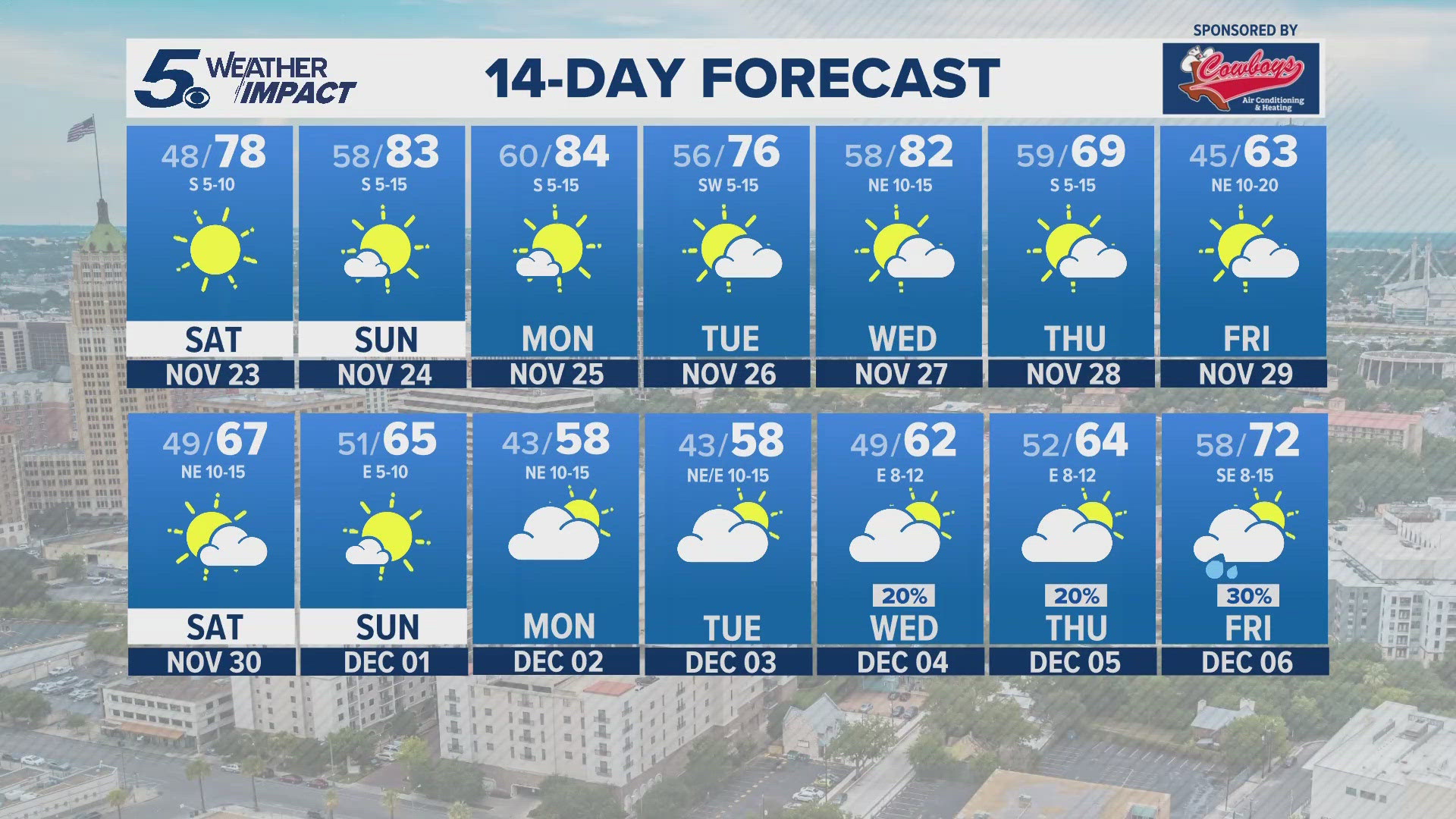
Another cold front won't be far behind; it's expecting to move in on Monday (Veterans Day) and it will be stronger. In fact, this could be the strongest cold front of the season so far.

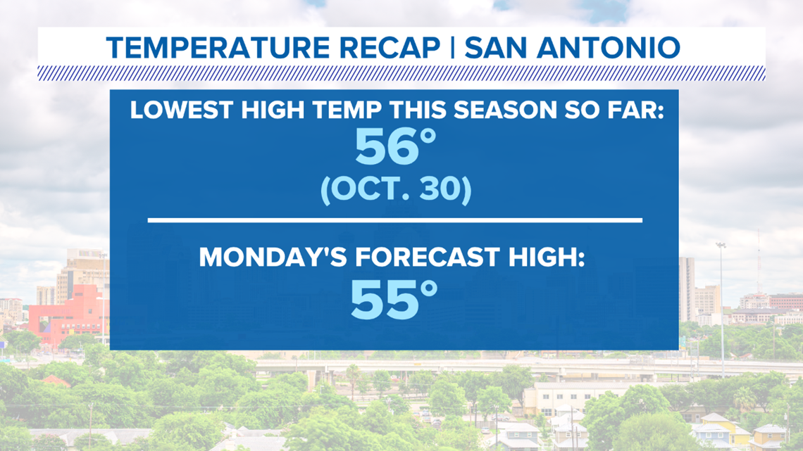
Temperatures will fall into the upper-40s to low-50s early next week. Overnight temperatures will likely tumble into the 30s. Wind chill will bring the mercury down into the low to mid-20s Monday night.

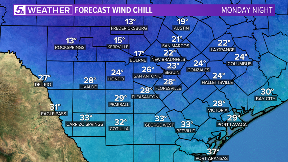
Well below-normal temperatures may stick around Tuesday and Wednesday next week.

Most of us could see one to three inches of rain through next Wednesday. Both cold fronts will bring rain chances for Bexar and surrounding counties.

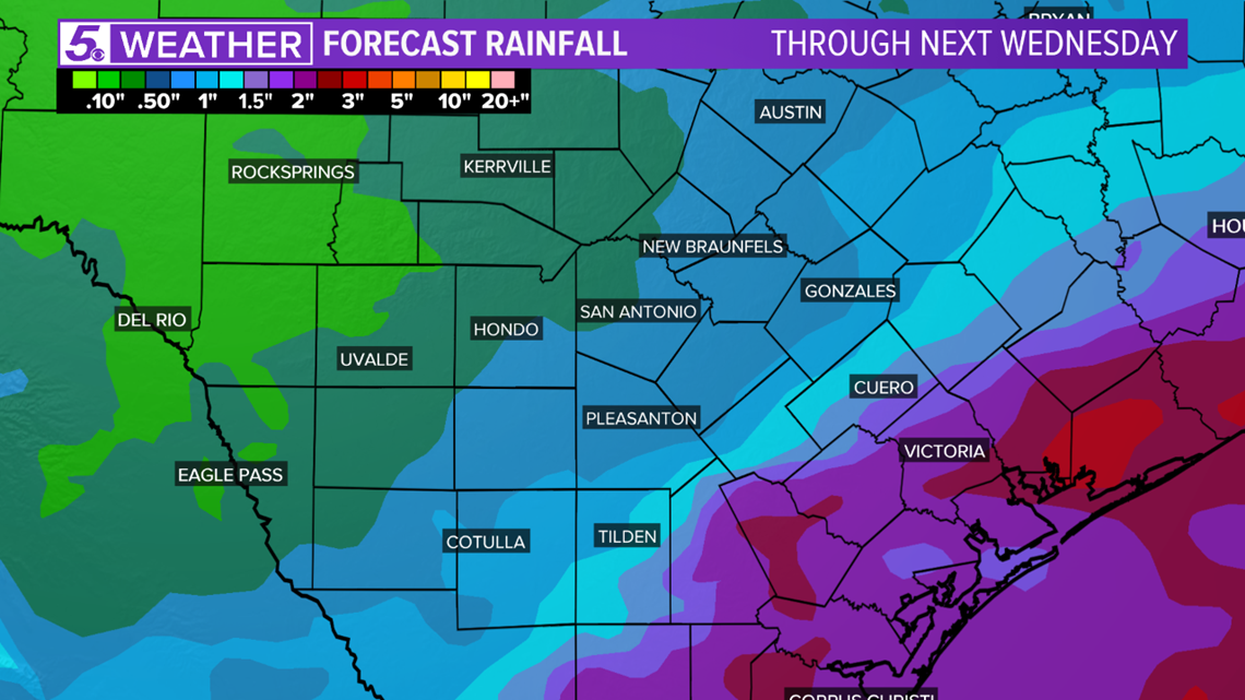
Keep in mind that our second cold front is still several days away. Rain chances and temperatures may change each forecast update.
RELATED: How clouds affect our temperatures

