SAN ANTONIO — A cold front has moved through the San Antonio area, bringing temperatures down.
CPS Energy reported more than 2,400 customers are without power Monday afternoon. But as of 6:00 p.m., power had been restored to most customers
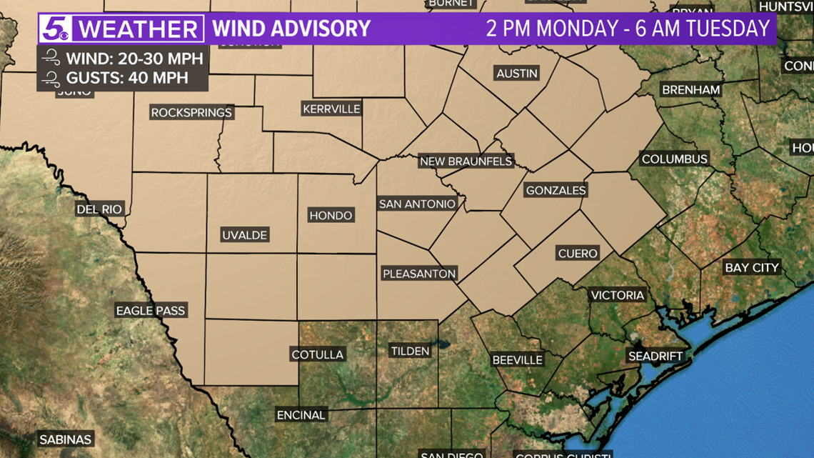
A Wind Advisory will be in effect for Bexar and surrounding counties from Monday afternoon through Tuesday morning. As the strong cold front moves in, we will have a north wind sustained at 20 to 30 miles per hour with wind gusts up to 40 miles per hour. Hang on to your hats!

As for rain coverage, numerous (80%) showers likely after 1 p.m. Monday and showers will linger into the evening hours.
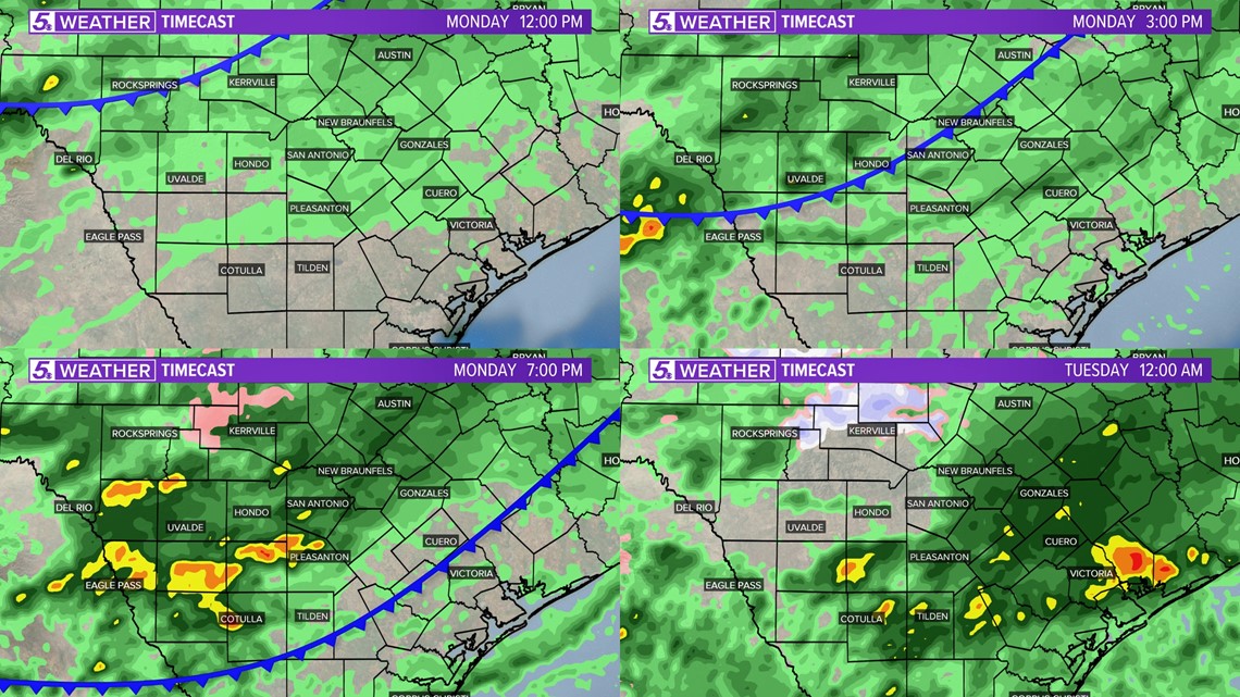
Here's a look at the rain and cold front timing:

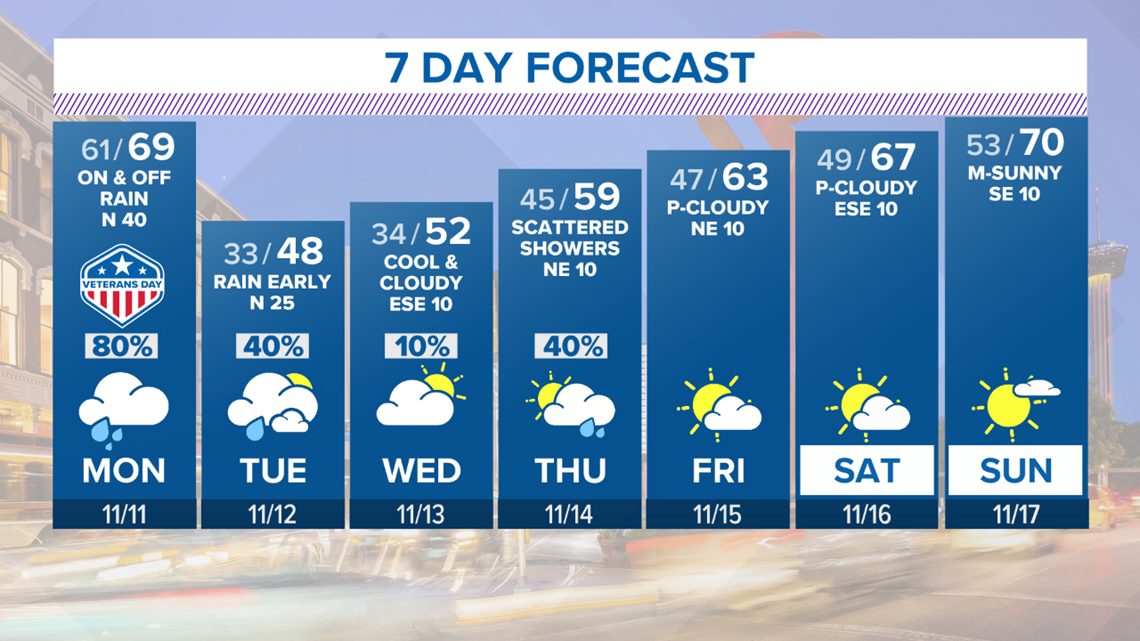
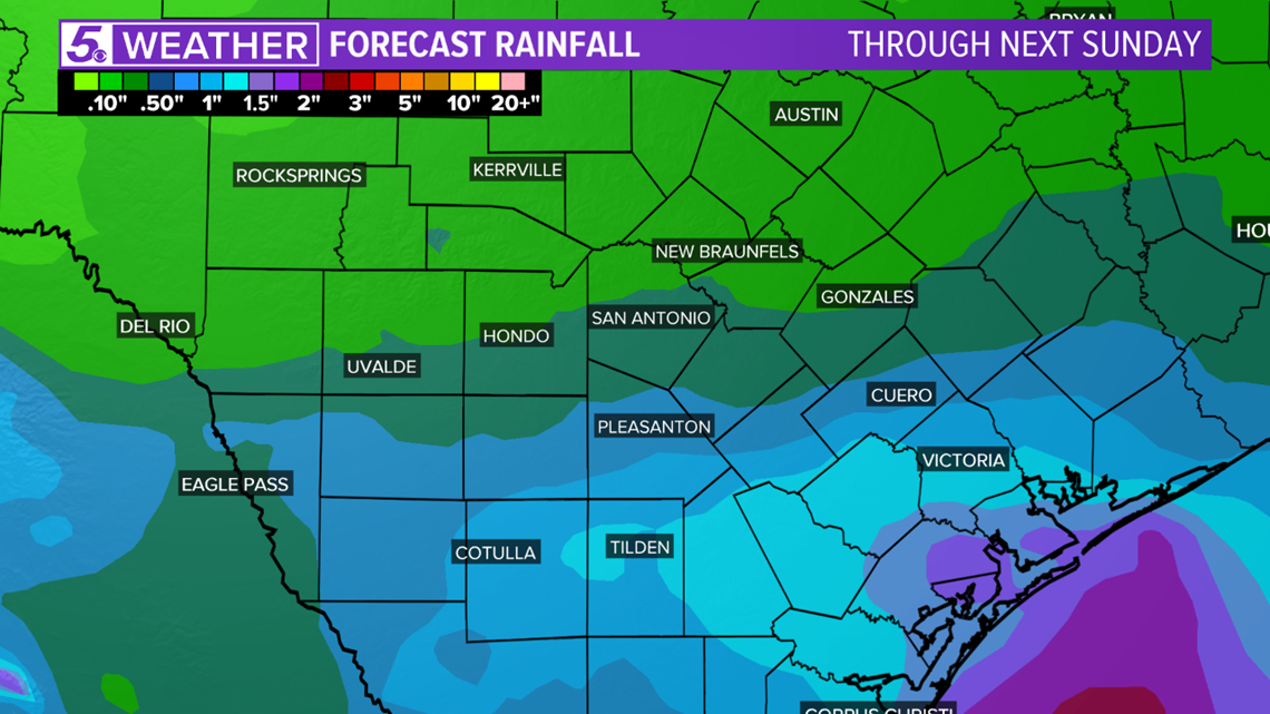
Most of us will pick up half an inch up to an inch of rain over the next 7 days.

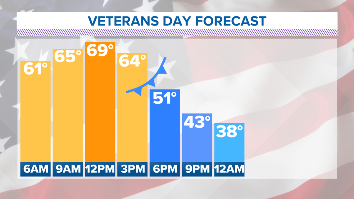
Don't let morning temperatures fool you! It will be a warm start to the day then temperatures will tumble after the cold front moves through.

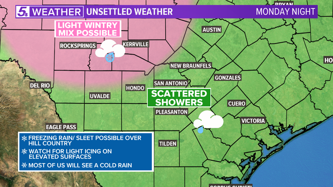
Parts of the Hill Country may see some freezing rain or sleet late Monday night into Tuesday morning. Areas north of Bandera will need to watch for icy spots on elevated surfaces Tuesday morning. Most of South Texas will see a cold rain.

It will be tough to get out of bed Tuesday morning! We will be waking up to temperatures in the upper-20s to low-30s around sunrise.

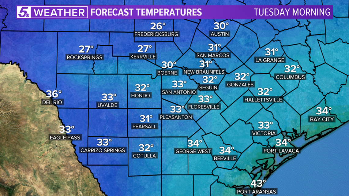
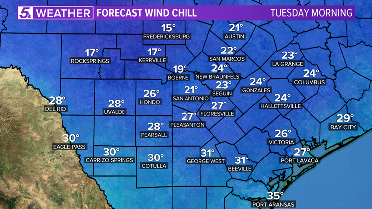
Wind chill in the teens over the Hill Country and low-20s for most counties. Keep the outdoor pets in mind and make sure they have a warm place to shelter from the cold. Don't forget to protect sensitive vegetation and watch your tire pressure, too.


Stay warm on Tuesday! Fall-like weather will return next weekend.

