There's a reason hurricane season runs through Nov. 30.
The tropics have once again come alive and there's one system out there that our meteorologists are keeping a close eye on. On Monday morning, Tropical Depression 26 strengthened into Tropical Storm Delta. By Monday night, Hurricane Delta was forecast to become a Cat 3 storm in the Gulf of Mexico before making landfall later this week.
The National Hurricane Center will stop monitoring Gamma after it became Post-Tropical Cyclone Gamma in the NHC 10 p.m. update on Monday.
Interactive tropical tracker
Hurricane Delta
Hurricane Delta continues to strengthen as it nears the Gulf of Mexico. As of 4 am Tuesday, the storm's maximum sustained winds had increased to nearly 100 mph with higher gusts. Additional "rapid" strengthening is expected during the next day or so, according to the NHC. It's expected to be a major hurricane when it nears the Yucatan Peninsula Tuesday afternoon or evening.
The storm is moving toward the west-northwest at nearly 15 mph and a faster northwestward motion is expected Tuesday through Wednesday night.
Delta is expected to move into the southern Gulf of Mexico early Wednesday and be over the south-central Gulf of Mexico late Wednesday and Thursday.
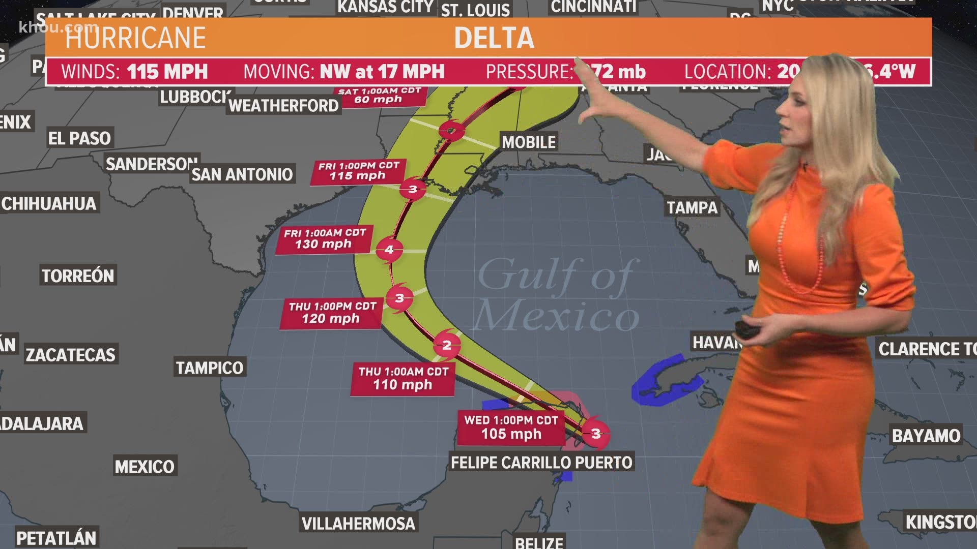
This is the latest forecast cone for Hurricane Delta
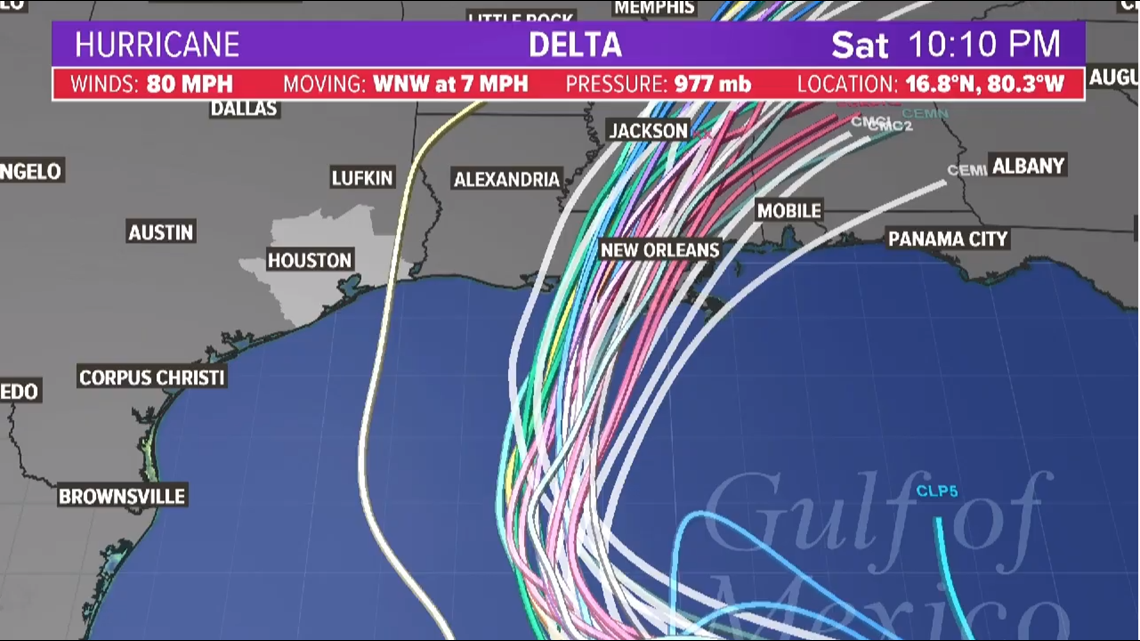
These are the latest spaghetti models for Hurricane Delta


1. Dangerous storm surge and hurricane conditions are expected within portions of the northern Yucatan Peninsula of Mexico beginning Tuesday night, and a Hurricane Warning is in effect.
2. Heavy rainfall will affect portions of Jamaica, the Cayman Islands, western Cuba and the northern Yucatan Peninsula during the next few days. This rainfall could lead to significant flash flooding and mudslides.
3. Tropical storm conditions are expected in portions of the Cayman Islands beginning Monday night or early Tuesday, and a Tropical Storm Warning is in effect.
4. Delta is forecast to approach the northern Gulf Coast late this week as a hurricane. While there is large uncertainty in the track and intensity forecasts, there is an increasing risk of dangerous storm surge, wind, and rainfall hazards along the coast from Louisiana to the western Florida Panhandle beginning Thursday night or Friday. Residents in these areas should ensure they have their hurricane plan in place and monitor updates to the forecast of Delta.
While most of the computer models take this well east of Houston, we'll need to monitor the system for any deviations west in its eventual track.
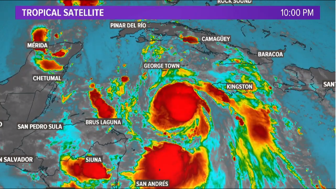
This is the satellite imagery of Hurricane Delta at 10 p.m. Monday


Post-Tropical Cyclone Gamma
Gamma formed Saturday and quickly powered up into a strong tropical storm with 70 mph winds. In fact, it strengthened so rapidly that the NHC was forced to issue a hurricane warning for the Yucatan Peninsula. In the NHC's 4 p.m. update on Monday, the storm had weakened into a tropical depression and at 10 p.m. the storm had weakened again.
Now Post-Tropical Cyclone Gamma the remnants of the storm are expected to produce an additional 2 to 4 inches of rainfall with isolated maximum amounts of 8 inches across portions of the Mexican states of Yucatan, Campeche, and Tabasco.
The post-tropical cyclone is currently centered along the northern coast of the Yucatan peninsula and will move inland through Monday. Maximum sustained winds are nearly 35 mph with higher gusts. Gradual weakening is anticipated and Gamma is forecast to dissipate by Wednesday.

