
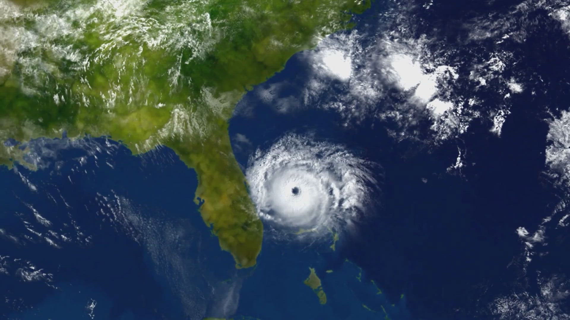
SAN ANTONIO — Hurricane Francine made landfall Wednesday in Louisiana as a Category 2 storm, bringing powerful winds, deadly storm surge and potential flooding on the northern U.S. Gulf Coast.
Francine drew fuel from exceedingly warm Gulf of Mexico waters. The cyclone had maximum sustained winds of 100 mph (161 kph) when it roared ashore in Terrebonne Parish, the Miami-based National Hurricane Center said.
Parts of Mississippi, Alabama and the Florida Panhandle were at risk of flooding starting Wednesday. The lower Mississippi Valley and lower Tennessee Valley could see flooding later in the week as the soggy remnants of Francine sweep inland.
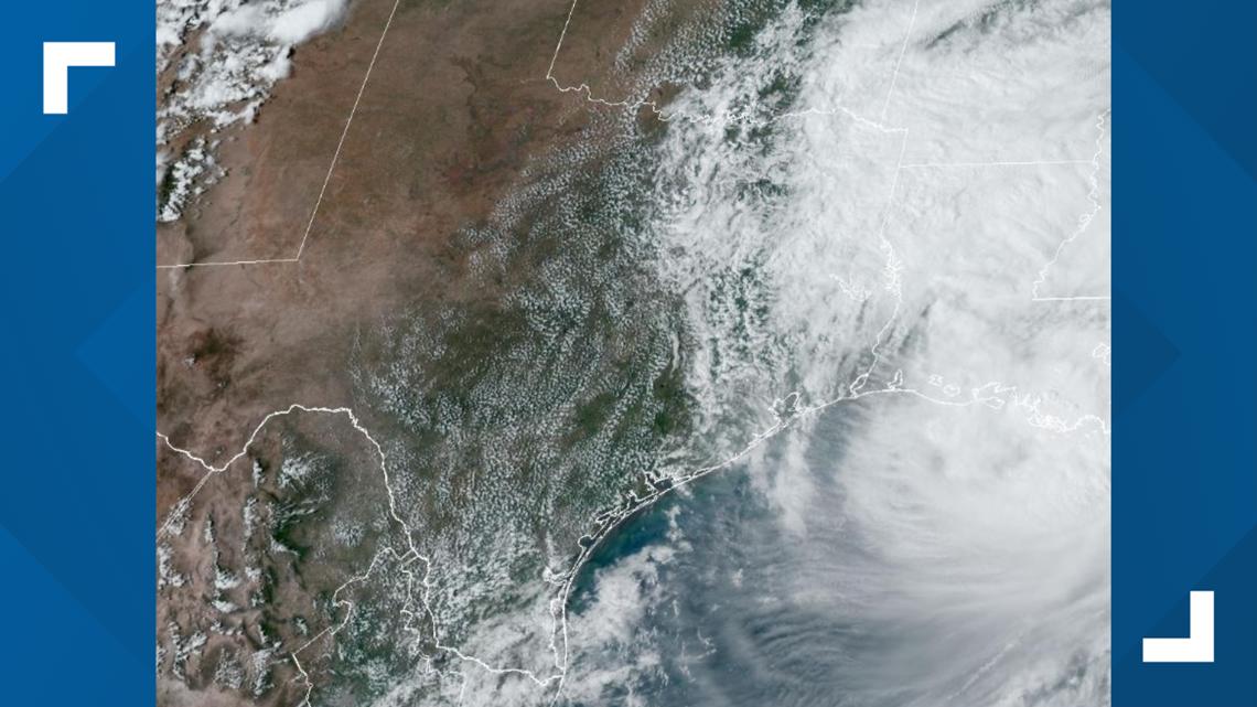
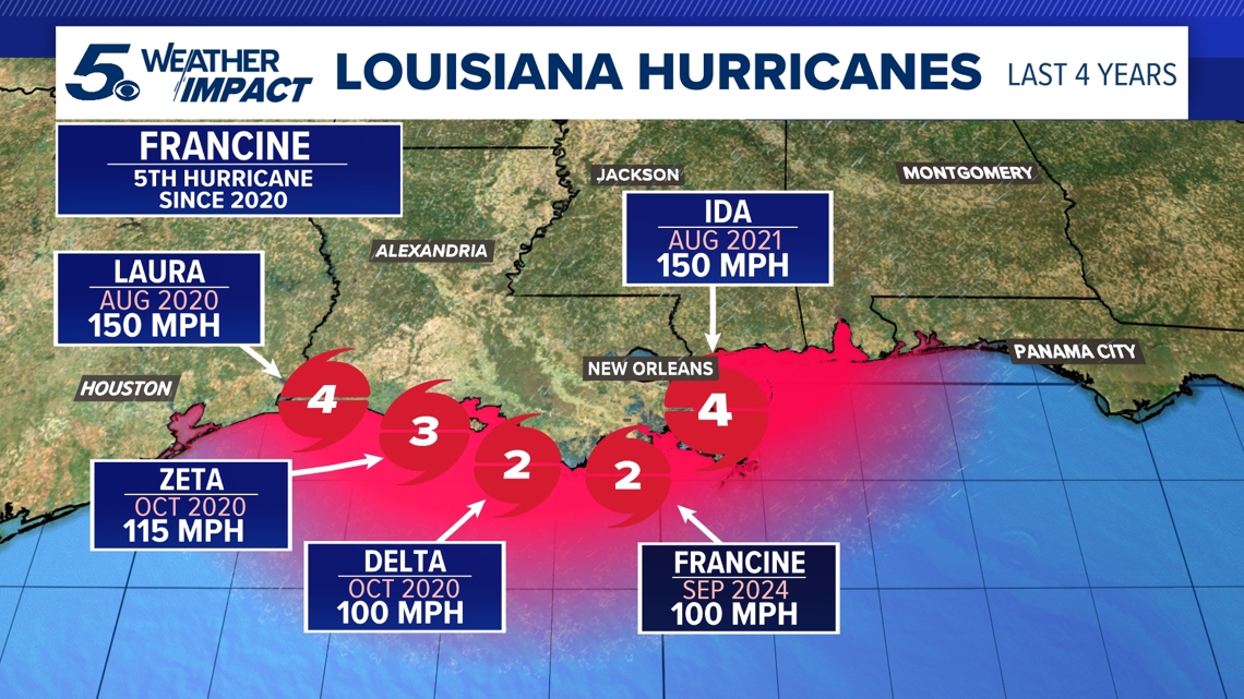
Francine aimed at a Louisiana coastline that has yet to fully recover from a series of devastating hurricanes in 2020 and 2021. The storm's consistent easterly track means it didn't have a life-threatening impact on Texas, save for some communities close to the Louisiana border.
Where is Francine now?
As of 5:10 p.m. Wednesday, the storm had made landfall in Terrebonne Parish, about 60 miles southwest of New Orleans. It's a Category 2 hurricane with maximum sustained winds of 100 mph.

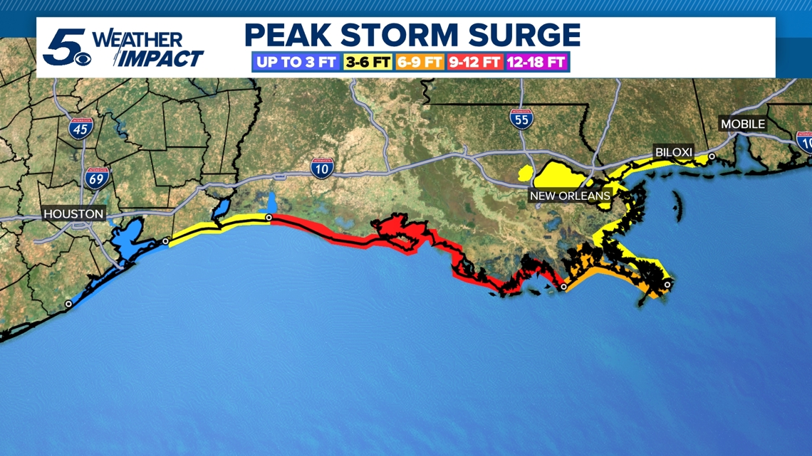
A hurricane warning was in effect along the Louisiana coast from Cameron east to Grand Isle, about 50 miles (80 kilometers) south of New Orleans, according to the center. A storm surge warning stretched from the Mississippi-Alabama border to the Alabama-Florida border. Such a warning means life-threatening flooding could occur.

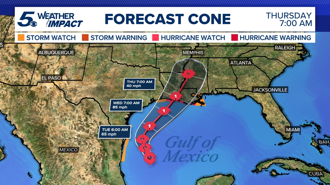
Francine took aim at a Louisiana coastline that has yet to fully recover since hurricanes Laura and Delta decimated Lake Charles in the region in 2020, followed a year later by Hurricane Ida. The hurricane is expected to bring storm surge of more than 12 feet in some areas of Louisiana.

Francine marks the fifth hurricane to make landfall in Louisiana in the last four years.

Which Texas communities were hit hardest?
Not that many, as it turns out, although coastal Flood Warnings were still in effect Wednesday afternoon for Chambers, Harris, Jackson and other nearby counties.
Rainfall amounts are expected to be less than an inch in coastal areas through Wednesday. Wind gusts could reach 15 to 25 mph, with slightly stronger gusts of 25 to 35 mph on the coast. Storm surge of up to three feet will be possible.
Will we feel major effects in San Antonio?
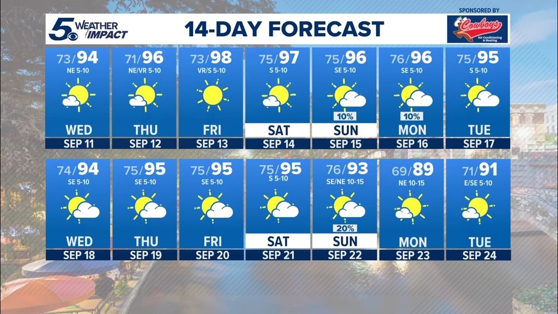
In short: No. Earlier this week, we were expecting some midweek showers in the Alamo City, but even those have dissipated to make way for sunshine and blue skies.
Alamo City residents enjoyed a brisker-than-usual start to September. The end of the week will bring highs of about 98 degrees, but San Antonio looks to be done with triple-digits for 2024 as fall conditions approach.
Sunday looks to bring the region's next shot at precipitation.

In the peak of hurricane season
We're keeping our eye on a couple other tropical storms that are on Francine's tail. The first few weeks of September are the busiest during hurricane season, but why?
Science can help explain. After every spring, ocean temperatures warm in the Atlantic and reach their highest temperatures as summer comes to a close. We're talking the last week of August heading into September, a time frame that provides fuel for a busy period in the tropics.
This, along with an overlap of favorable conditions like unstable air and Saharan dust, are the main reasons we see more tropical storms this time of year. As a result, September typically sees a third of the season's average of 14 storms. The hurricane season runs from June 1 to the end of November.
September has also observed more Category 5 hurricanes than any other month—21 different storms like hurricanes Irma, Rita, Dorian and Maria. Nine of those have formed 2004.
While September represents the highest threat for hurricanes, a secondary peak occurs around Oct. 15. Don't let your guard down, and stay weather-aware~