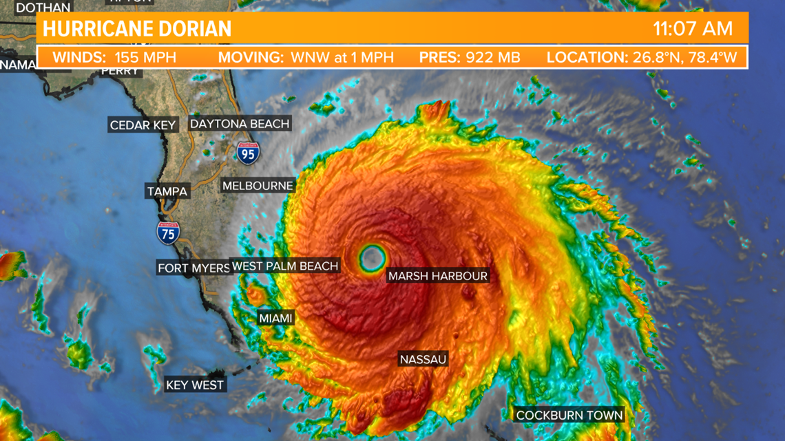
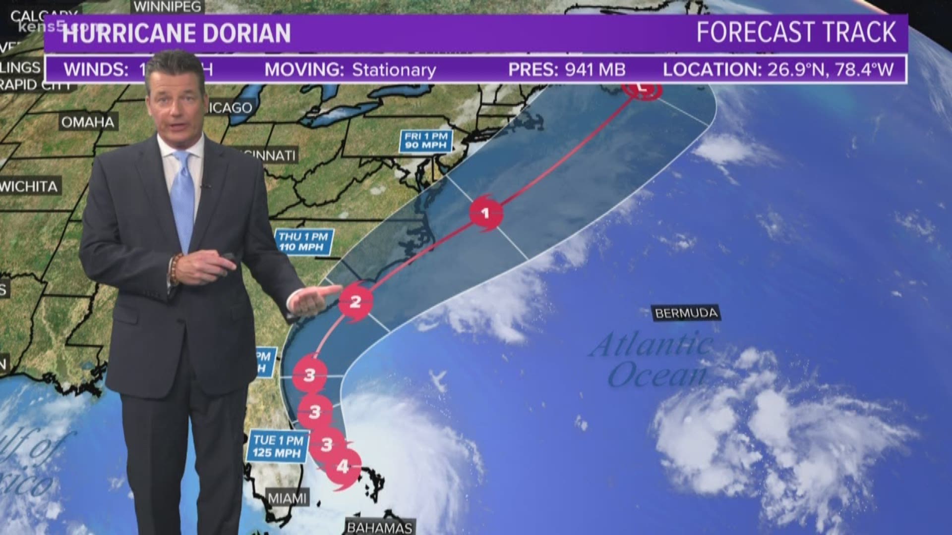
FLORIDA, USA — As of 4 p.m. Monday, Hurricane Dorian has sustained winds of 145 mph, making it a category four hurricane. The latest forecast still shows that a landfall in Florida is possible as the storm turns northward from the Bahamas. Landfall is also possible in Georgia and the Carolinas.


Urgent warnings were sent out for the Abaco Islands from the National Hurricane Center for residents to take cover on Sunday. For Labor Day, the storm is impacting the Abaco Islands still, while it moves over Grand Bahama.
On Sunday, the National Hurricane Center stated the storm had gusts more than 200 mph and a storm surge may be experienced in the Bahamas at a height between 18 to 23 feet.
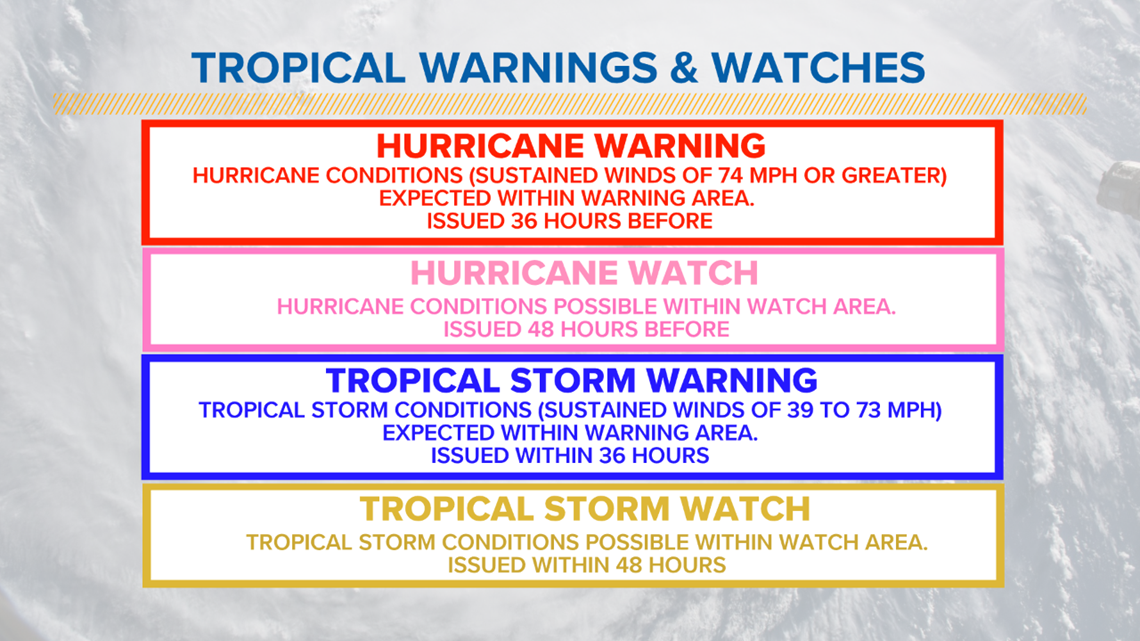
Hurricane Warnings and Watches are in place for the Bahamas and parts of the Florida coast. We will continue to watch the storm closely, but no impacts are expected for Texas.


Here's the difference in tropical warnings and watches:


Impacts from the storm, in areas effected, include high wind gusts, heavy rain, flash flooding, and dangerous storm surge.
The Air Force Reserve 53d Weather Reconnaissance Squadron (Hurricane Hunters) and NOAA Corps have been flying the storm, gathering data to perfect the model forecast for days and they are expected to continue flying the storm up until landfall.
RELATED:
The storm is forecast to dump a high amount of rain across Florida and into other parts of the southeast over the next week. If you have friends or family living in Florida, give them a call to make sure they understand the forecast and what the storm's impacts may be.
The storm isn't expected to cause any impacts to Texas, but we will continue to keep you updated in case things change.
PEOPLE ARE ALSO READING:

