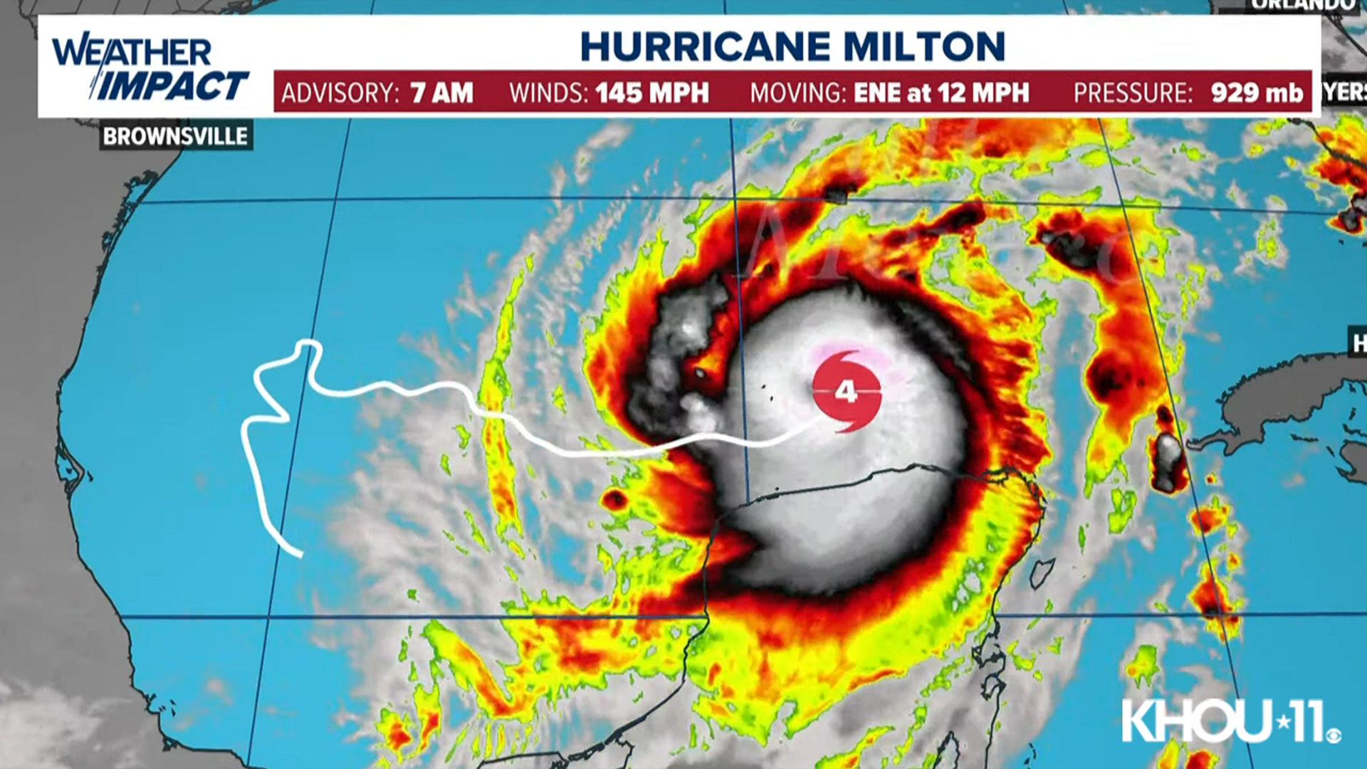
HOUSTON — Hurricane Milton continues to move across the Gulf of Mexico. It's now a Category 4 hurricane.
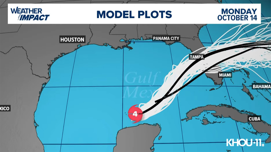
Right now, all of the global and hi-res models are in agreement in taking this across the Gulf toward the western Florida coast. With the 7 a.m. update, the storm had maximum sustained winds of 145 mph as it moved to the east-northeast at 12 mph.
Folks living in Florida need to take necessary safety measures regarding Milton. This is the second time Florida will be under threat of a landfalling hurricane within the past two weeks. Right now the official forecast from the National Hurricane Center (NHC) takes Milton into the Tampa Bay Area as a Category 3 storm on Wednesday. If this verifies, it will be the first time in over 100 years that the city has taken a direct hit from a hurricane.

Storm surge and wind in this scenario will be significant leading to widespread flooding and power outages that may last for days if not weeks. Folks in this area need to monitor this forecast carefully as the exact point of landfall will become clearer over the next few days.

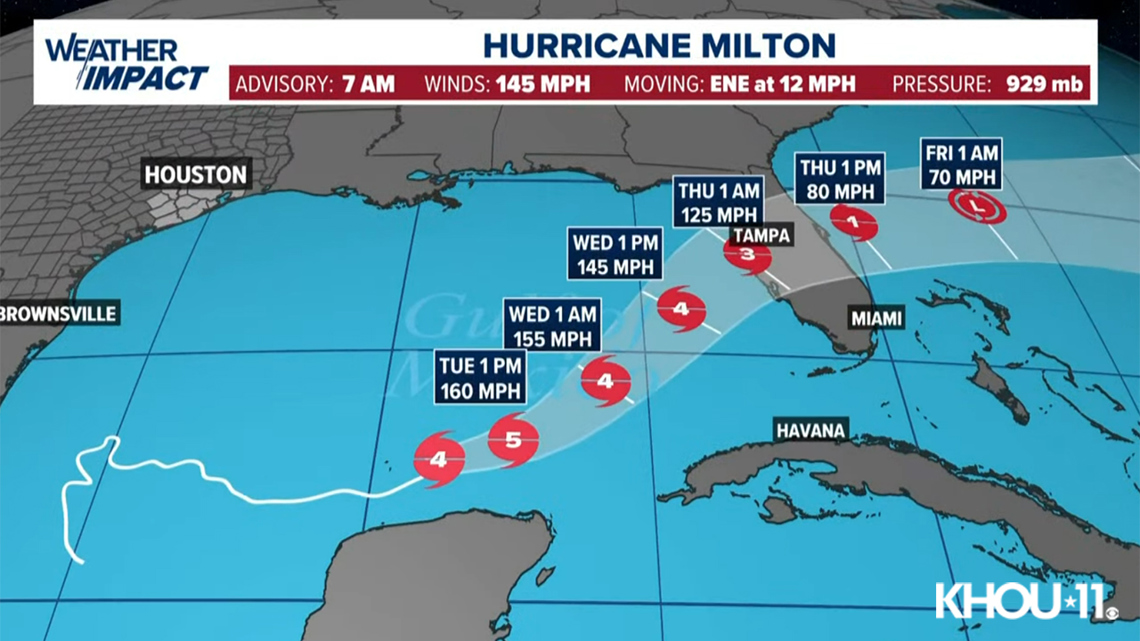
Storm surge is going to be a major impact on Florida, regardless of strength. When a hurricane increases in intensity, a wall of water starts to build around the storm. Even if the storm weakens, that wall of water doesn't diminish. As a result, even though Milton is expected to make landfall as a weakening storm, the storm surge impacts will still be that of a category 4 or 5 hurricane. With over 12 feet of seawater, inundation is expected in the areas hardest hit by the storm. As a result, evacuation orders are already underway.
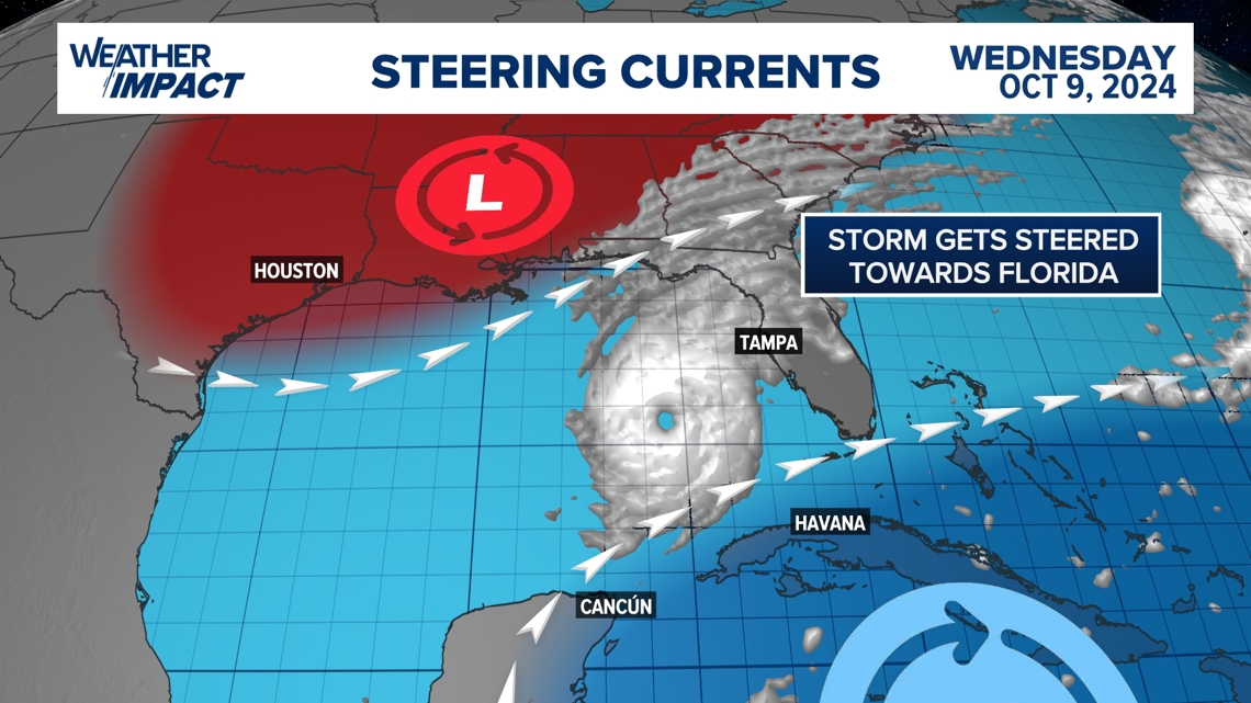
For us in Texas, there is zero chance of this storm moving north into the Upper Texas Coast. The reason is a fall front that will drop humidity and bring gorgeous weather to the area this week. That front will be responsible not only for deflecting Milton away from the Western Gulf but also for steering it into Florida.