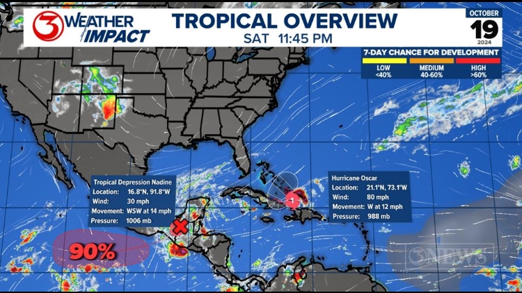
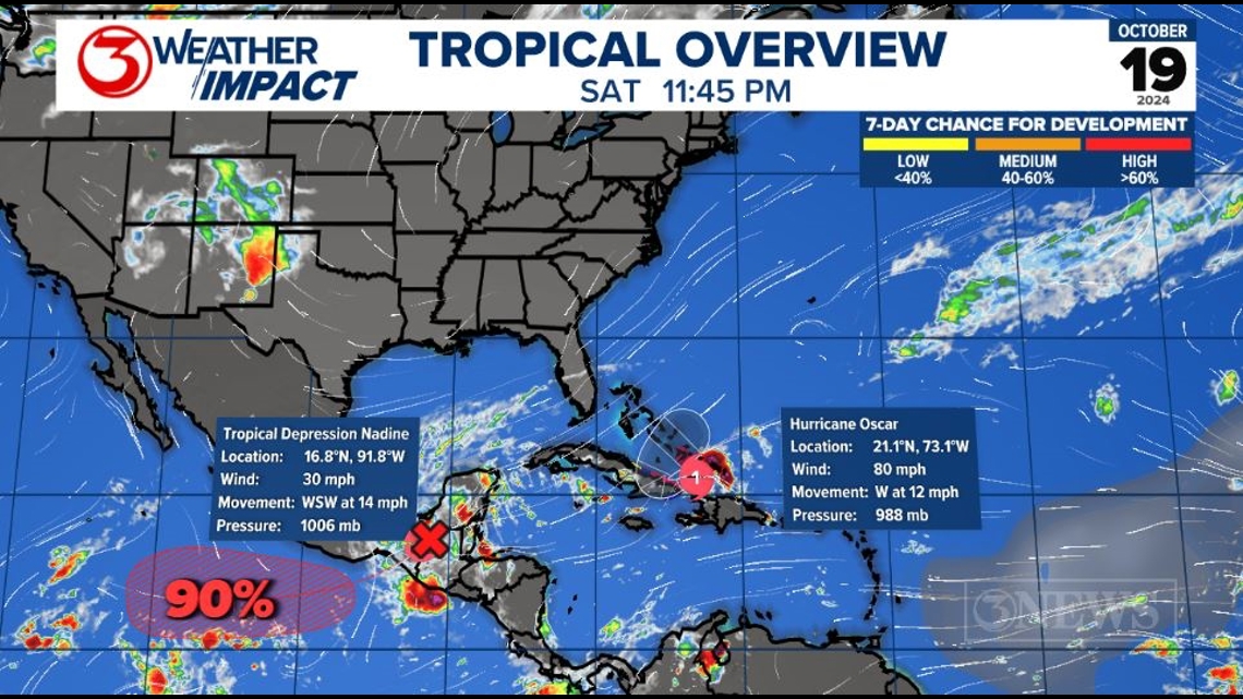
CORPUS CHRISTI, Texas — The NHC is currently monitoring Tropical Depression Nadine and Hurricane Oscar - both in the Caribbean, but neither a threat to Texas.

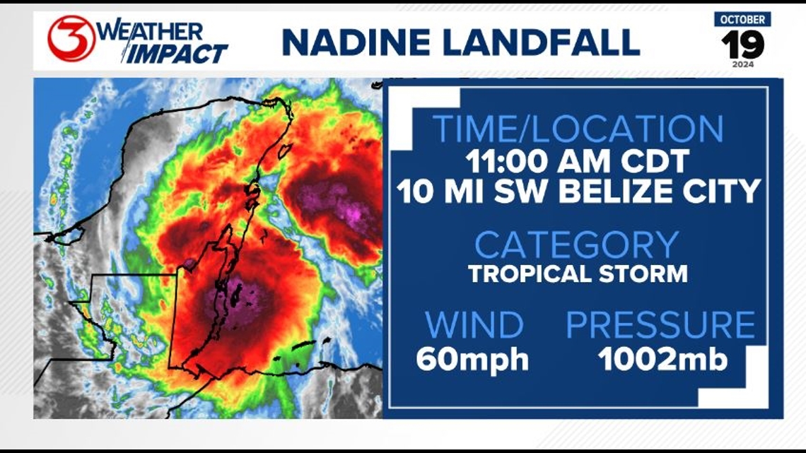
Nadine made landfall late Saturday morning as a 60 mph tropical storm. It is now a tropical depression moving across Central America.

That being said, that likely won't be the end of Nadine. The remnants of Nadine will move across Central America and into the Eastern Pacific, where an area of interest with a high chance of development is being marked.
If Nadine completely dissipates and a storm re-forms in the Pacific, it would take the name Kristy. The current forecast cone for Nadine takes the system into the Pacific, so we'll have to wait and see if it completely dissipates before then or not.

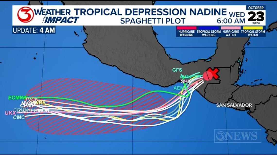
Once it crosses over, Nadine/Kristy is expected to quickly intensify as it moves farther into the Eastern Pacific.

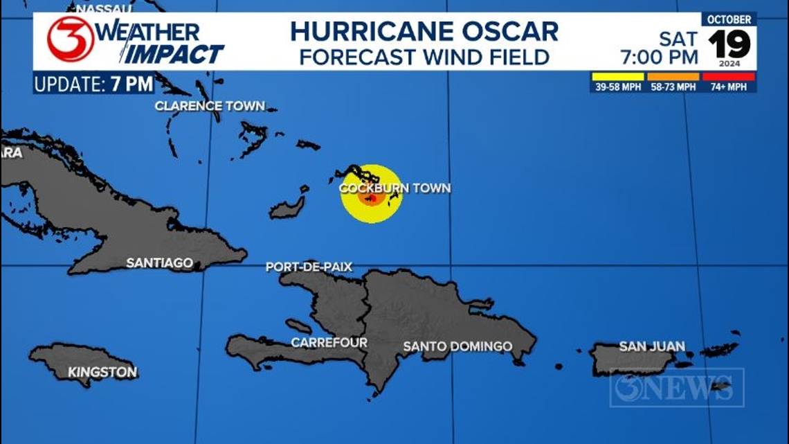
Oscar seemingly came out of nowhere Saturday morning. Previously Invest 94-L, it held on to at least a low chance of development as it moved across the Atlantic the last week and a half.
The reason Oscar popped up so quickly? Its size. It's absolutely tiny. Granted, it has grown a bit since yesterday when its hurricane-force wind field only reached 5 miles across.
Small storms are able to fluctuate in strength much more rapidly than a large storm, so the NHC will be monitoring this system closely as it moves through the northeastern Caribbean.

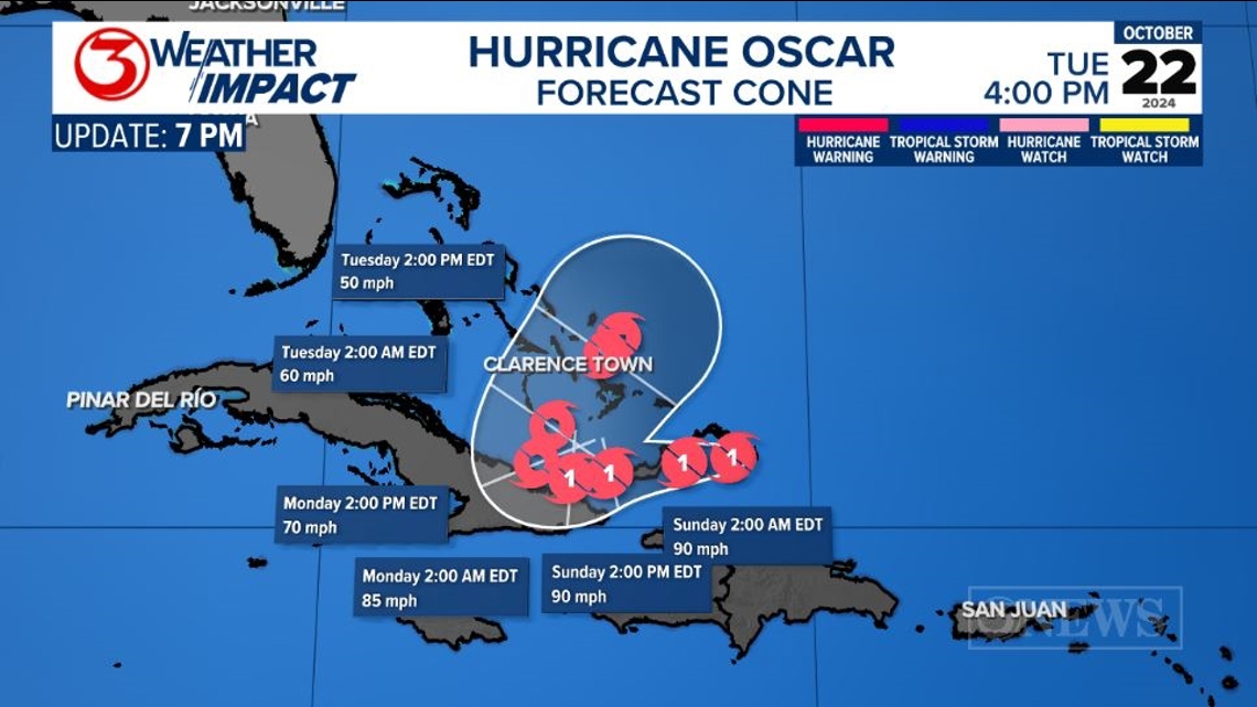
Oscar made landfall along the Inagua Islands early Sunday morning and is expected to continue moving west towards Cuba before turning to the northeast and moving back over The Bahamas.

---------------------------------------------------------------
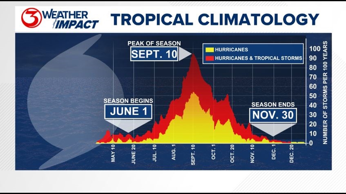
The Atlantic Hurricane Season runs from June 1 to November 30, with the peak of the climatological peak of the season happening on September 10.

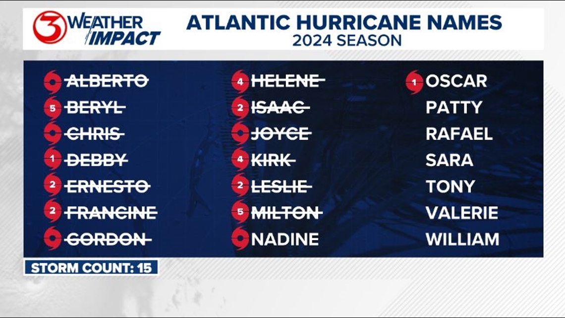
Here are the names for the 2024 Atlantic Hurricane Season. Names are given to tropical cyclones (tropical storms and hurricanes).

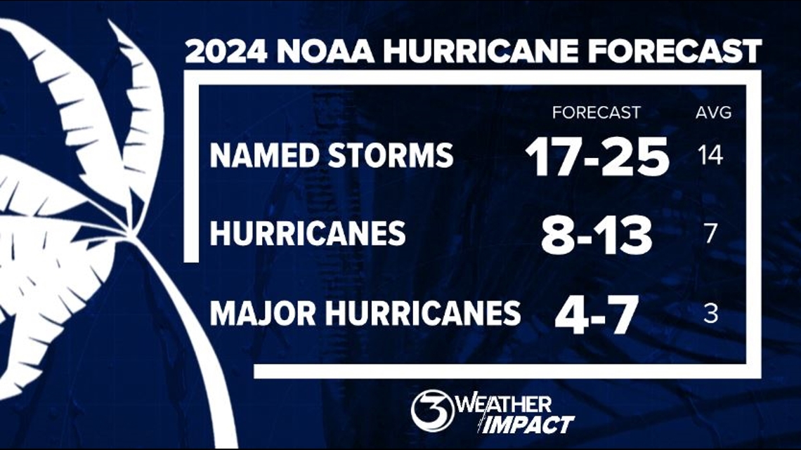
On May 23, NOAA released their forecast for the 2024 Atlantic Hurricane Season. They're predicting an above-average year, with 17-25 named storms. This is the highest pre-season forecast they've ever issued.
The high number of storms forecast is due to near-record sea surface temperatures and the return of La Nina, both of which favor tropical cyclone development. We talk more about those in our Hurricane Special, which you can watch here!

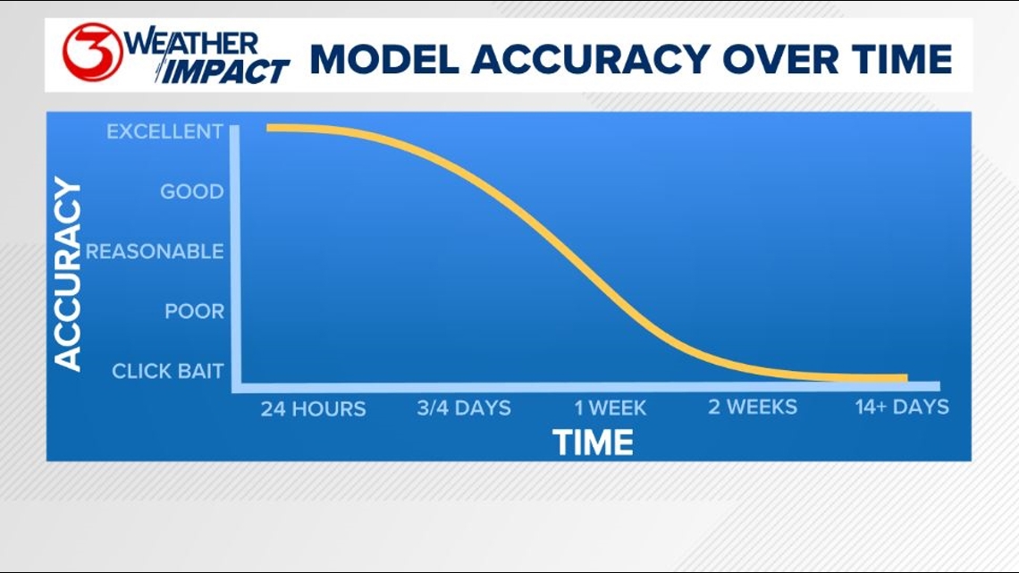
Remember to not "anchor" to the first forecast you see - forecasts change. Also, rely on a credible source for your tropical information and forecasts.