SAN ANTONIO — It's no joke San Antonio needs rain and luckily one of two cold fronts this week bring good chances to the Alamo City.
In addition, the second front will send a near 15-degree drop in high temperatures for a taste of fall weather. This cooler weather will be welcomed after an October mini-heatwave with San Antonians experiencing temperatures in low 90s over the past couple days.
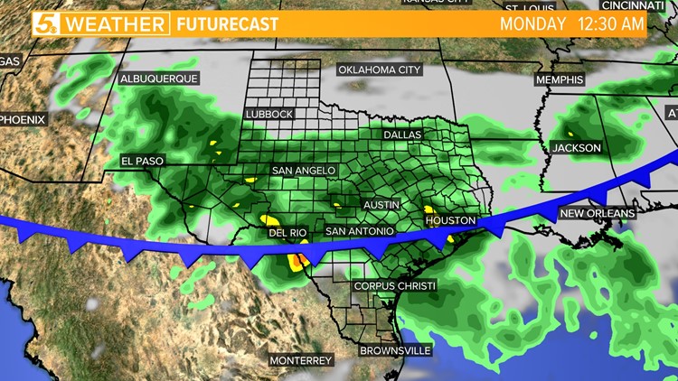
The first front arrives overnight Wednesday and will be felt early Thursday morning setting up a dry and comfortable weather pattern. The second front comes into the city Sunday night pushing cooler weather and rain to start next week.
Here's what you can expect for next 7 days:
Thursday (High 91 and Low 68): Plenty of sunshine is in store warming temperatures once again in the low 90s, however it won't feel like the 90s thanks to the dry air pushed in from the early morning front. There will also be a northeasterly breeze with wind gusts 15-20 mph.
Friday (High 90 and Low 65):The morning will feel quite comfortable with temperatures starting in the mid 60s and dry air still in place. High temperatures should be slightly cooler than Thursday since more clouds will be in play but still rising to the low 90s.
Saturday (High 92 and Low 69): A southeasterly flow will return increasing our humidity levels. Winds could gust 12-15 mph. If you have outdoor plans this weekend then Saturday is the day to enjoy them because rain chances increase beginning Sunday.

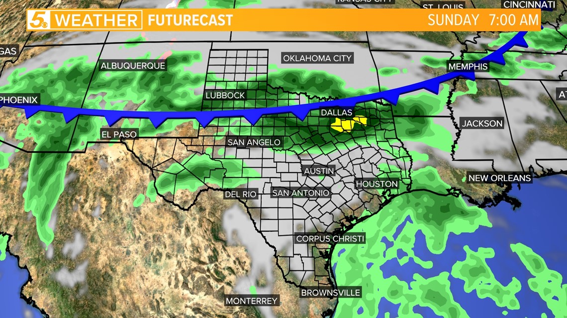
Sunday (High 91 and Low 72): Shower/storm activity will increase Sunday evening as our fist noticeable cold front of the season arrives. Overnight the cold front will move past San Antonio allowing cooler, fall-like weather to set in.
Monday (High 77 and Low 67): Rain is expected to continue Monday but we're still early to give specifics on timing and rain amounts. However, chances look really good. One model has rain amounts over 1.5 inches. Temperatures are also looking incredible to head out to those pumpkin patches.
From Sunday to Monday a near 15-degree drop in temperatures will set up placing afternoon highs only in the 70s over the next couple of days!
Tuesday (High 74 and Low 59): Temperatures will continue to drop overnight granting those early risers the pleasure to wear a long-sleeved shirt and light jacket. On this day San Antonians will wake up to temperatures in the upper 50s.
As you prepare for the day remember to dress in layers because temperatures will rise for the afternoon but only into the mid-70s! Tuesday rain chances will be low at 30 percent.

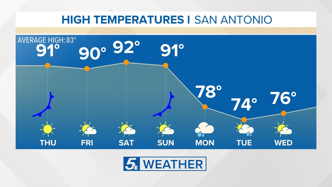
Wednesday (High 76 and Low 60): The pleasant weather continues. Skies are expected to be partly cloudy with dry air still in place. This means the cooler weather hangs around. Another day of dressing in layers with cool mornings and pleasant afternoons are in store.
Although this cold front won't be drastically dropping temperatures it's definitely something to get excited about. October is typically the month when we start to see some good changes in temperatures pushing out that dreadful San Antonio heat and humidity.
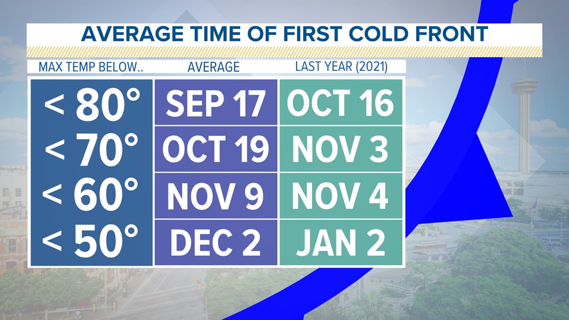
The average time of year when we see high temperatures drop below 70 degrees in around Oct. 19. Fingers crossed this weather stays around for Halloween.

