
SAN ANTONIO — A front is scheduled to move through San Antonio Friday evening bringing a chance of shower activity and chilly morning temperatures.
San Antonio is currently at a Marginal Risk (level 1 out of 5) for severe weather. This means if severe storms form potential hazards will include damaging winds, hail and tornadoes are all possible threats with this system. Since the front will be fast-moving flooding is a low concern.
Here's what San Antonians need to know about the front:
Friday morning: Light shower activity is possible Friday morning ahead of the cold front.
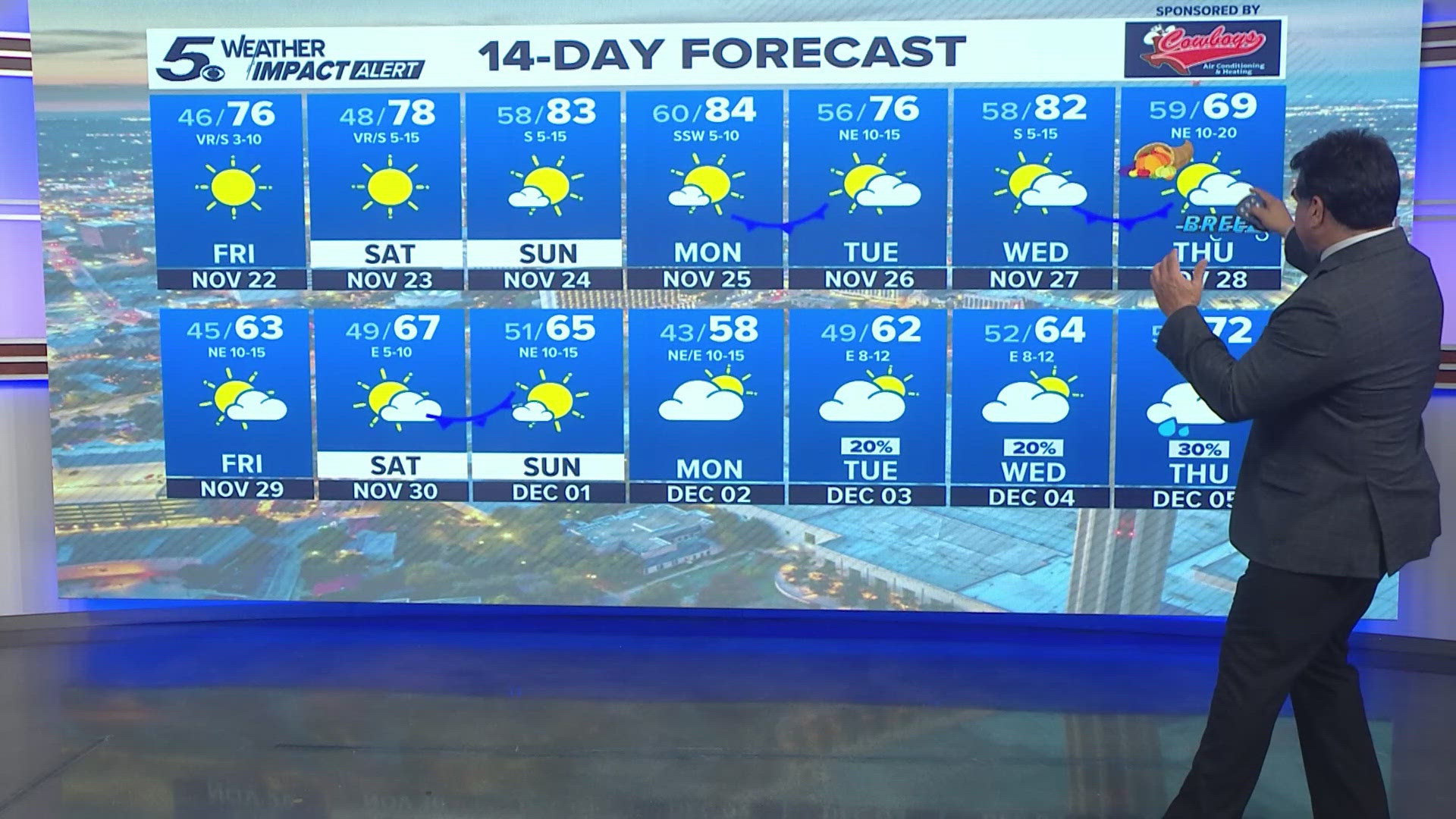
Friday afternoon: Since the front doesn't move through the city until evening high temperatures will still reach the mid 80s. Cloud cover will also hang around.
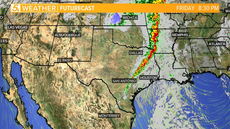
Friday night: The front should move through San Antonio sometime between p.m. Weather models indicate much of the rain and storms will stay to the north and east of Bexar County.
Models are showing San Antonio will be on the tail-end of the front. Keeping rain and storm chances at 20 percent. Residents east of San Antonio will have a better chance of rain and storms.
The front should pass San Antonio by 10 p.m. allowing temperatures to drop in the mid-50s by Saturday morning.
The front will allow for a beautiful weekend with low temperatures in the 50s and high temperatures in the low 80s. Enjoy!
Don't forget to turn the clocks back before going to bed Saturday night for Daylight Savings Time happening Sunday, November 6 at 2 a.m.