
SAN ANTONIO — Parts of Bexar County received over an inch of rainfall after showers drenched the region on Tuesday, with more expected later this week.
San Antonians can expect two more rounds of rain, along with a chance of storms, gusty winds and severe weather.
Here's what San Antonians need to know:
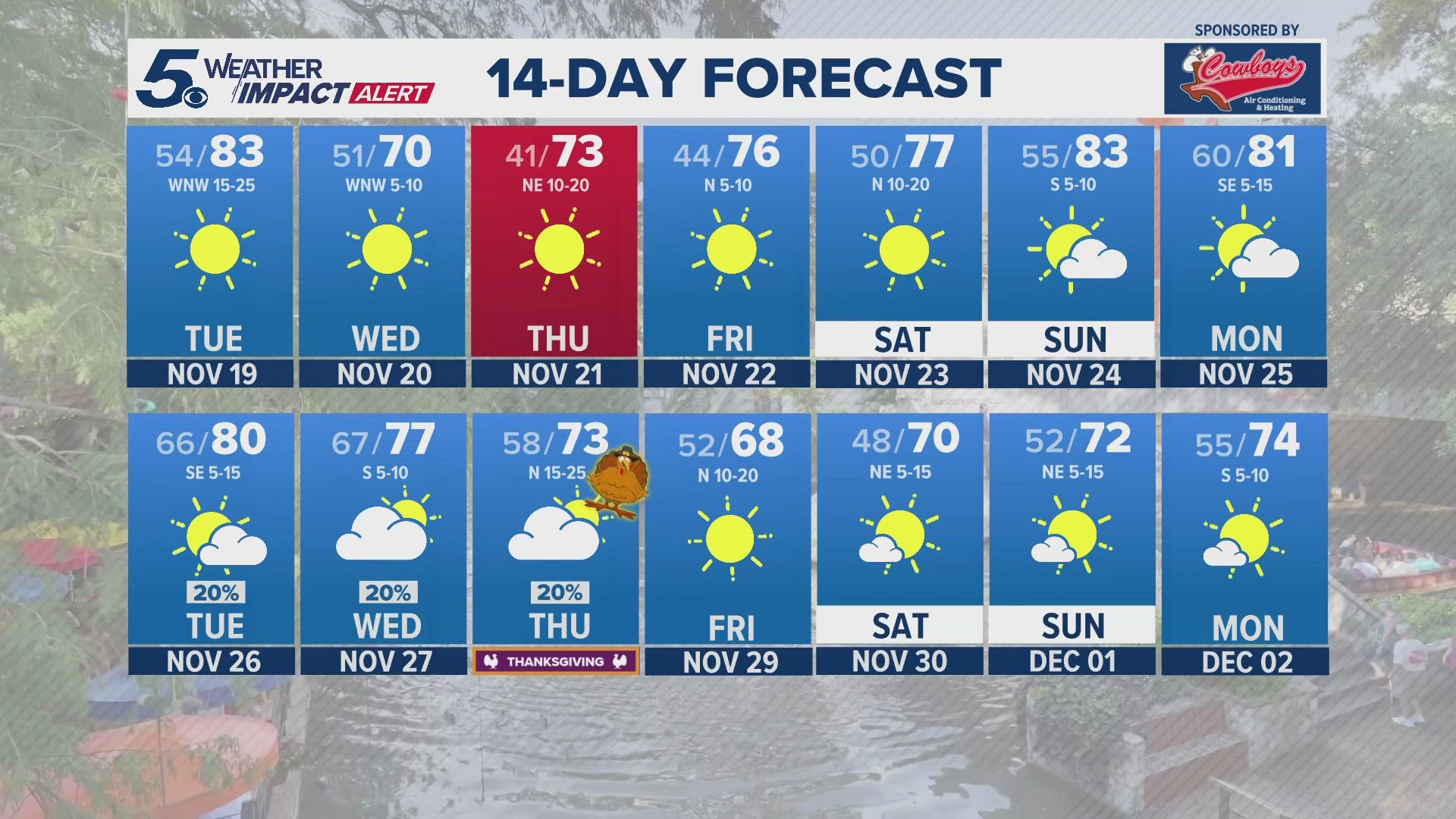
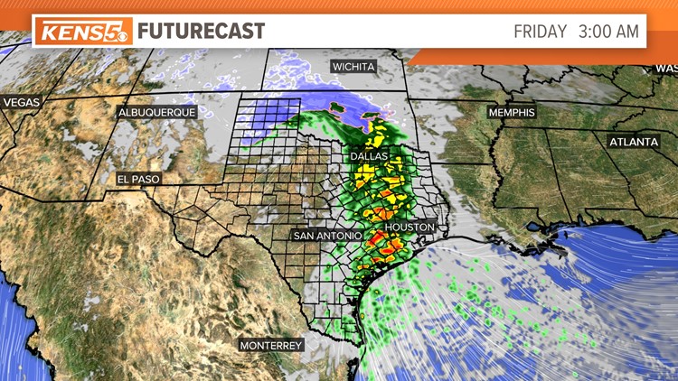
Thursday (High 56 and Low 42): Fog is possible in the morning. Clouds will hold steady, keeping temperatures in the mid-50s. Rain is also possible during the day for San Antonio area and Hill Country.
By the evening widespread rain will move in overnight as an upper level low arrives bringing a possibility of storm development. Most storms will stay to the east of San Antonio.

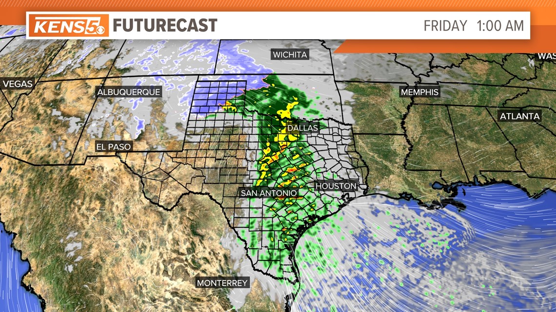
Friday (High 68 and Low 47): Early-morning showers from overnight will end by noon. Early-morning fog is also possible. San Antonians should finally see sun by the afternoon as temperatures warm into the upper-60s.
Weekend: A much more mild weekend with temperatures staying in the upper-60s to near 70 degrees on Saturday and Sunday. Morning temperatures stay chilly in the 40s, but quickly warm up by noon with plenty of sunshine. San Antonians will want to go outside and enjoy!
Monday (High 70 and Low 54): An upper-level low will move towards San Antonio by early morning. This, combined with higher moisture levels, could allow for severe storm development with gusty winds of 40 mph and sustained winds of 20 to 25 mph.

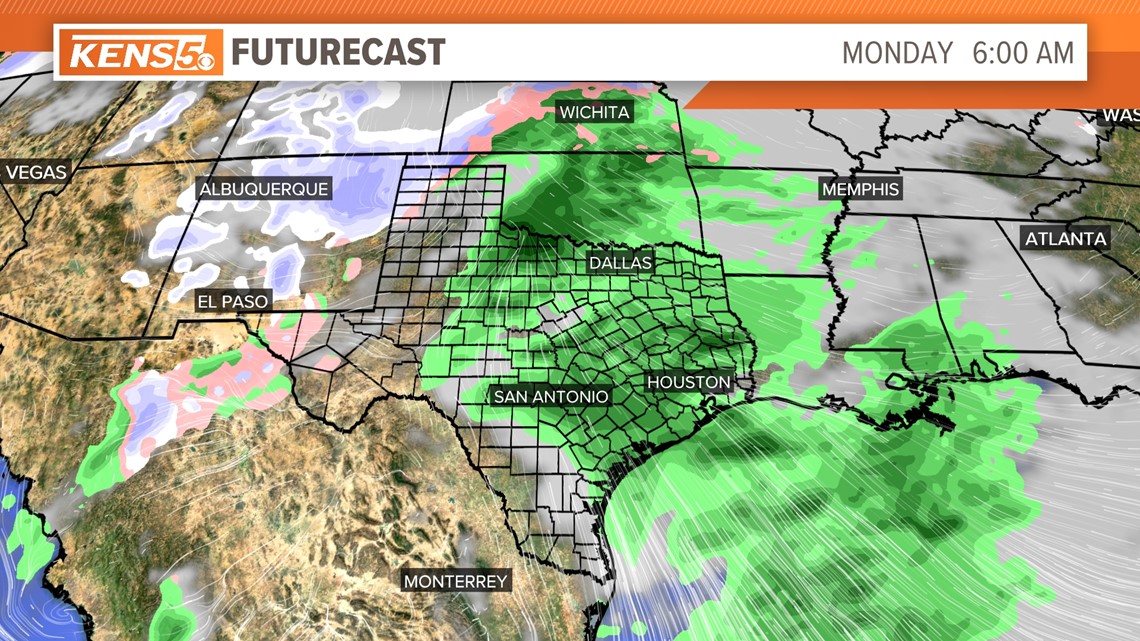
This system will bring a cold front that will drop overnight temperatures to the 30s. We will continue to monitor this system for any changes.
Sweater weather returns with highs only in the 50s and lows in the 30s for next Tuesday and Wednesday.