
SAN ANTONIO — Temperatures are dropping in San Antonio and will continue to plummet as rain turns to ice Thursday.
The city has been under a Winter Weather Advisory since 6 a.m. Thursday, and that advisory will last until 9 p.m., according to the National Weather Service.
San Antonio is also under a Wind Chill Advisory beginning tonight at 9 p.m. and last until 9 a.m. on Friday, according to National Weather Service.

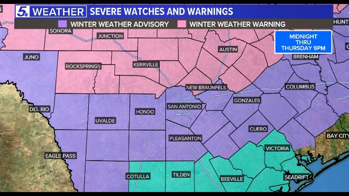
The NWS also placed the Hill Country, including cities such as New Braunfels and Kerrville, under a Winter Storm Warning beginning Wednesday night at midnight and lasting until 9 p.m. Thursday.
Since temperatures in the Hill Country were dropping below freezing earlier on Thursday, a more significant icing event will occur there. However, San Antonians should still be aware of the hazards small amounts of ice could bring.
Here's what you need to know about San Antonio's winter weather alert:
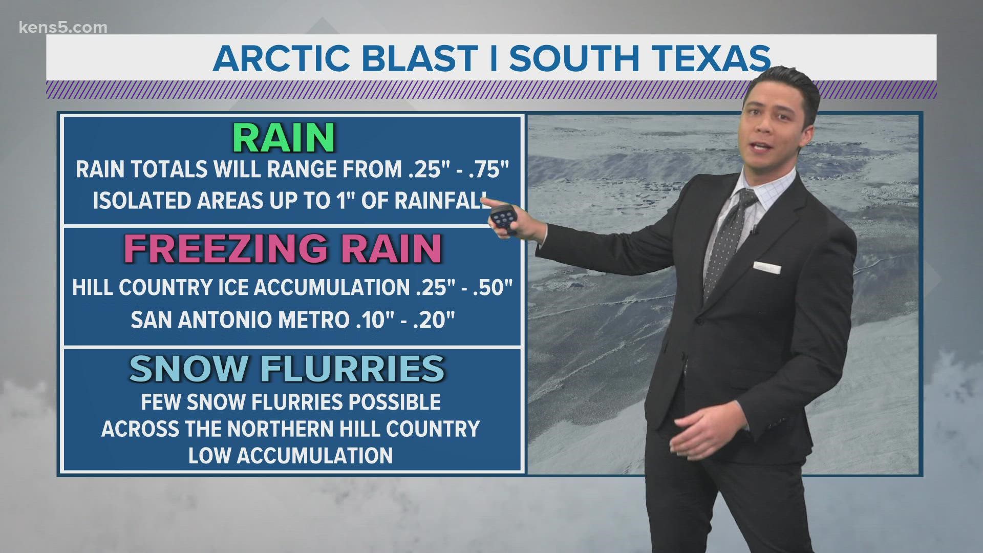
How much ice could we see?
Ice accumulations will vary but should stay around one-tenth of an inch. However, areas in north Bexar County could see ice up to one-quarter of an inch. This could lead to some icy glazing on roads and even sidewalks. Icy conditions may also form over bridges and overpasses.
What time will the frozen precipitation arrive?
Arrival time depends on your location. The Hill Country already has seen frozen precipitation overnight into Thursday morning. In San Antonio, rainfall began before morning rush hour, but temperatures weren't expected to drop below freezing until noon, allowing rainfall to turn into freezing rain. This event should end by around 4 p.m. Thursday; however, elevated roadways could could have an icy glaze as temperatures continue to fall.

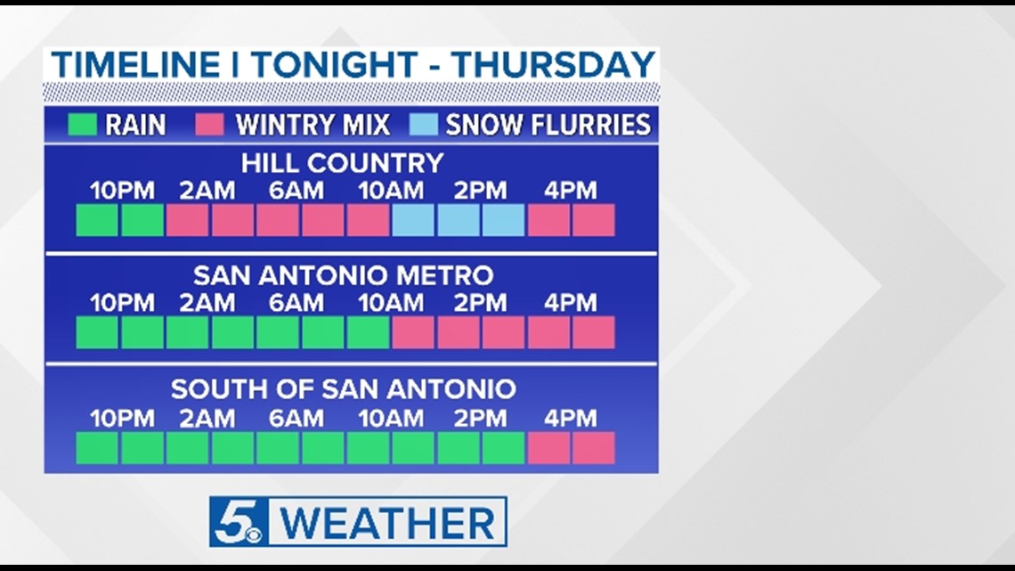
San Antonians should plan an alternate route if planning to travel between 11 a.m. to around 5 p.m. in case of road closures. Always drive slowly and use caution after frozen precipitation has fallen.
How cold will it get during the winter weather alert?
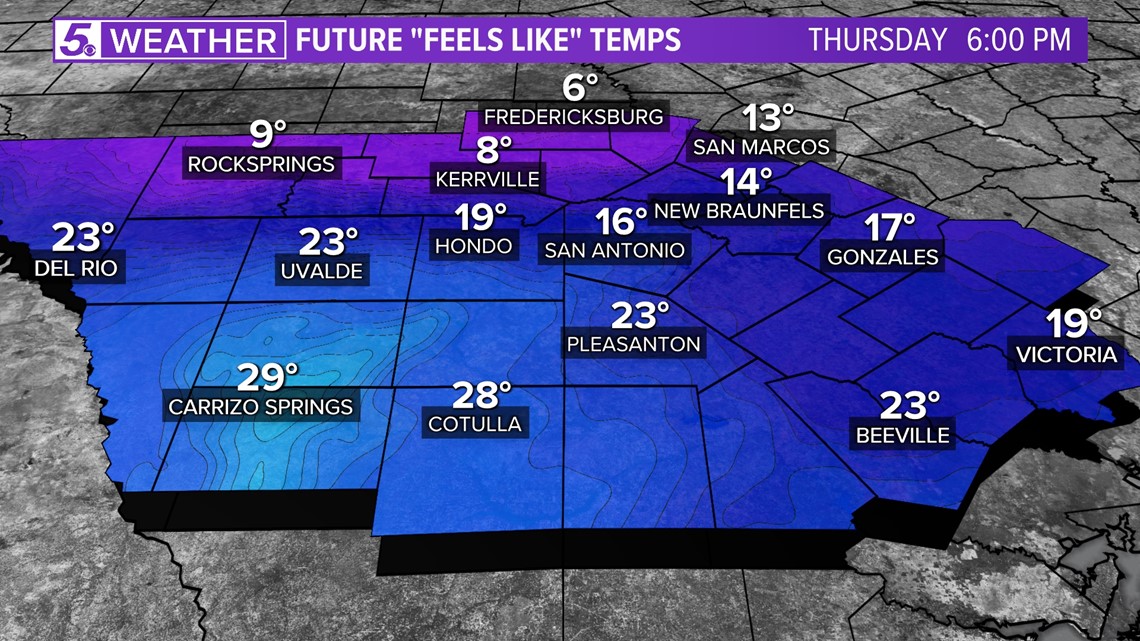
Temperatures dropped to freezing at 32 degrees on Thursday morning. By late evening at 10 p.m., temperatures are expected to be at a frigid 25 degrees.
In addition, winds will be gusting up to 35 mph and will produce wind-chill values in the teens and even the single-digits across our region by early evening on Thursday. Dress in layers!

How should I prepare?
Remember the 4 P's of people, pets, pipes and plants. A hard freeze is expected Thursday night and Friday night. San Antonio could experience freezing temperatures for around 30 hours, causing pipes to freeze and potentially burst if preventative measures are not taken. Remember to drip those faucets!