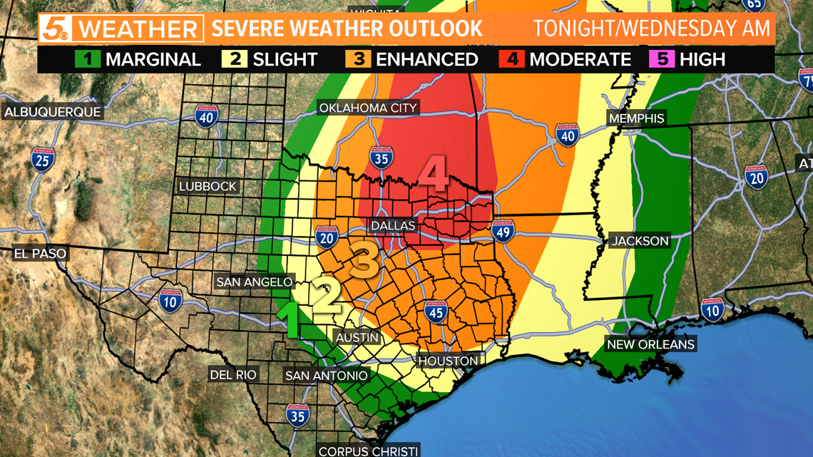
SAN ANTONIO — For tonight into Wednesday morning, strong to severe storms are expected to move through Texas with a higher chance for severe weather occurring in North Texas up into Oklahoma.
The latest severe weather outlook now has Dallas-Fort Worth under a level four (out of five) moderate risk. This means widespread severe thunderstorms are likely Tuesday night into Wednesday morning. The main threat for North Texas will be damaging wind gusts up to 75 mph.
South Texas' risk for severe weather will be more into the Wednesday morning time frame with a level one marginal risk for severe weather.
While our chance for seeing severe storms is much lower than our friends in North Texas, it is important to stay weather aware.
The main risk for the storms in South Texas will be damaging wind and large hail north of I-10 and for some areas east of I-37 down to the coastal bend.

A healthy line of showers and thunderstorms will develop over Oklahoma into North Texas then this line will dive south. All of these storms will be occurring ahead and along a cold front that will be moving through Tuesday night and into Wednesday.
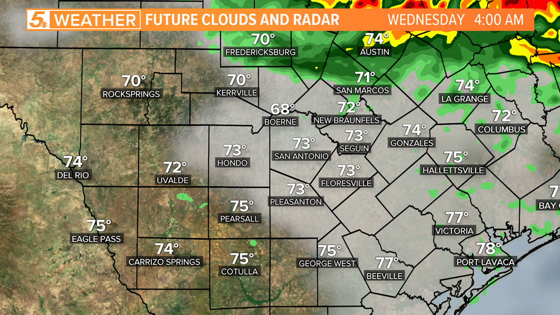
The latest timing for the strong to severe storms shows them approaching the Austin area closer to 4 a.m. on Wednesday.

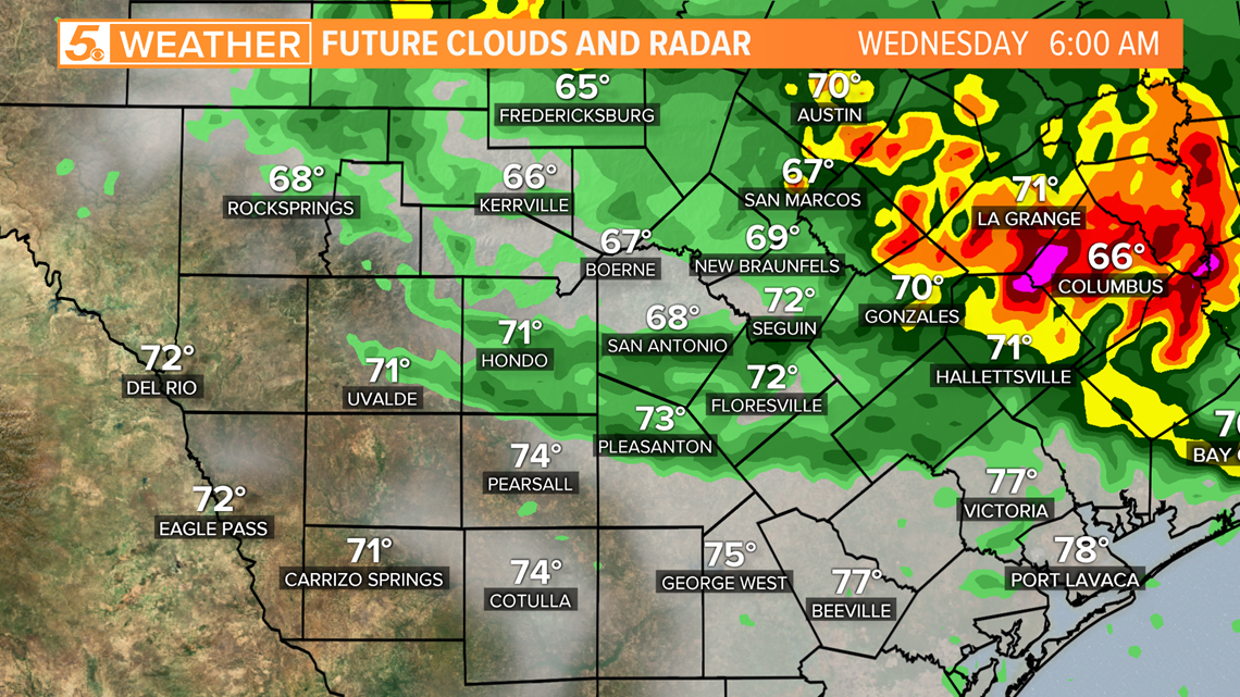
As we move through the morning, storms will continue to dip south, with the strongest of the storms likely staying east of the I-35 corridor by 6 a.m.

By 8:30 a.m., lingering storms will still be impacting parts of the I-10 corridor, but a majority of the stronger storms will have dipped south to the Victoria and Port Lavaca areas.

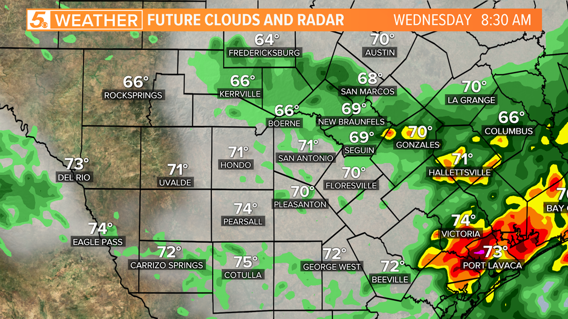
At 10 a.m., storms will start to move out of the region with just a few lingering around the coastal bend of Texas.

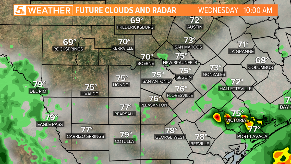
Quieter conditions will start to settle in behind the storms for Wednesday afternoon with a few showers still possible.
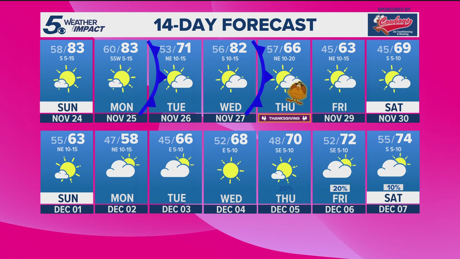
We will see lots of sunshine on Thursday and Friday.
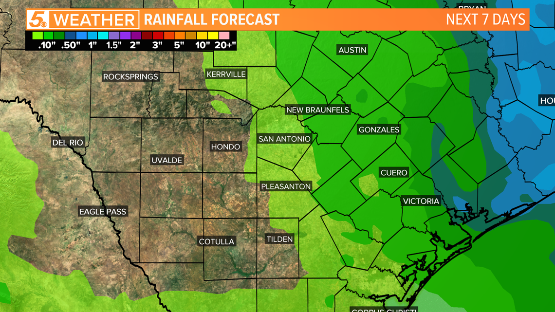
The amount of rain South Texas can expect to see over the next seven days will be less than half of an inch with a majority of the rain east of I-35.
Some spots west of I-35 will make it through the next seven days without seeing a drop of rain.

Don't forget you can download the KENS 5 app for the latest news and weather information each day while you are on the go.
PEOPLE ARE ALSO READING:


