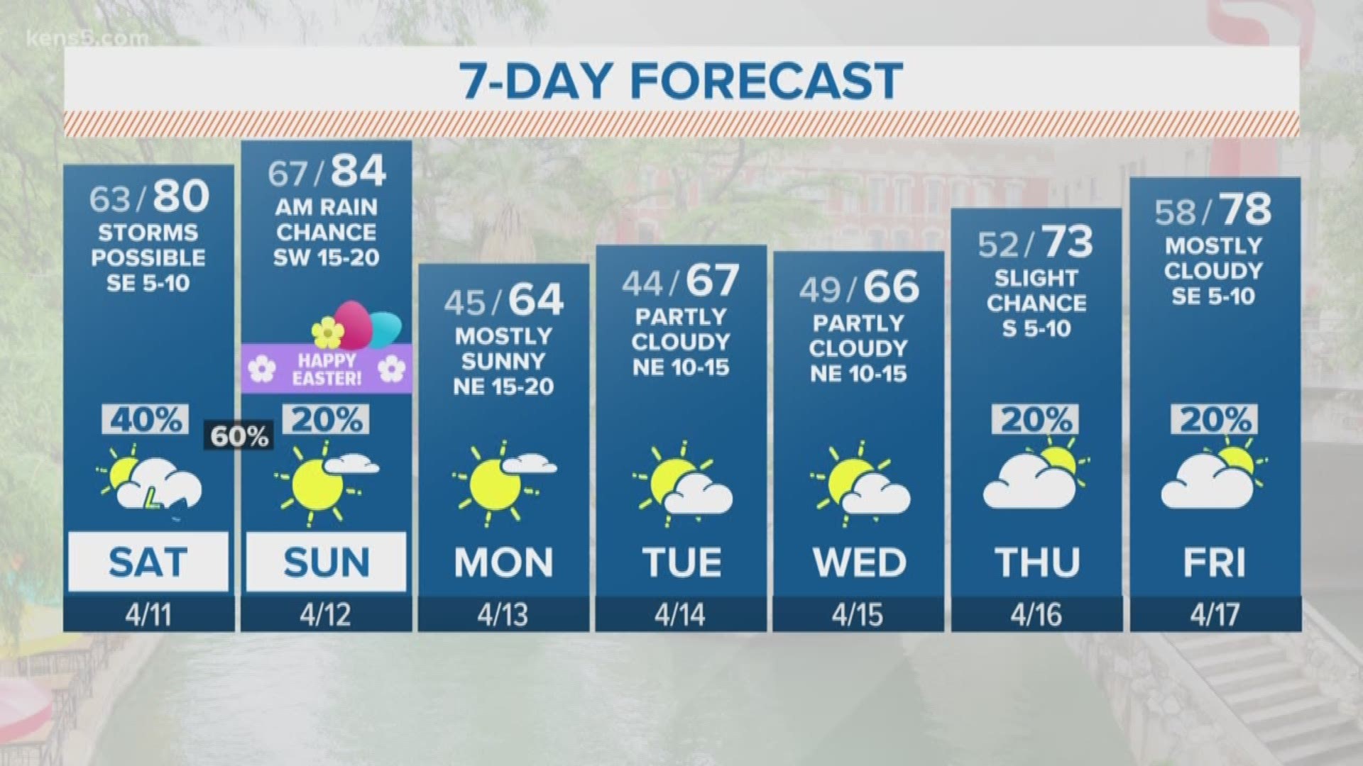
SAN ANTONIO — South Texas missed out on showers and storms Friday night and into Saturday, but a higher chance for showers and storms is expected to move in for Saturday night and into Sunday morning.
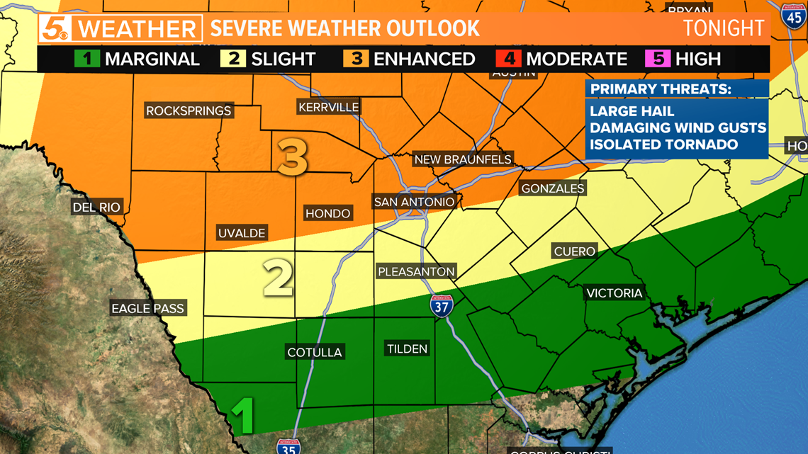
With the higher chance for showers and storms, we are expecting an increased chance for severe weather.
An enhanced risk for severe weather is in place for South Texas as storms start to move into the region around midnight.
Much of the storms are expected to be in the Hill Country, stretching down to Bexar County. Some storms will stretch south of Bexar County, but the further south you go, the less likely storms will be severe.

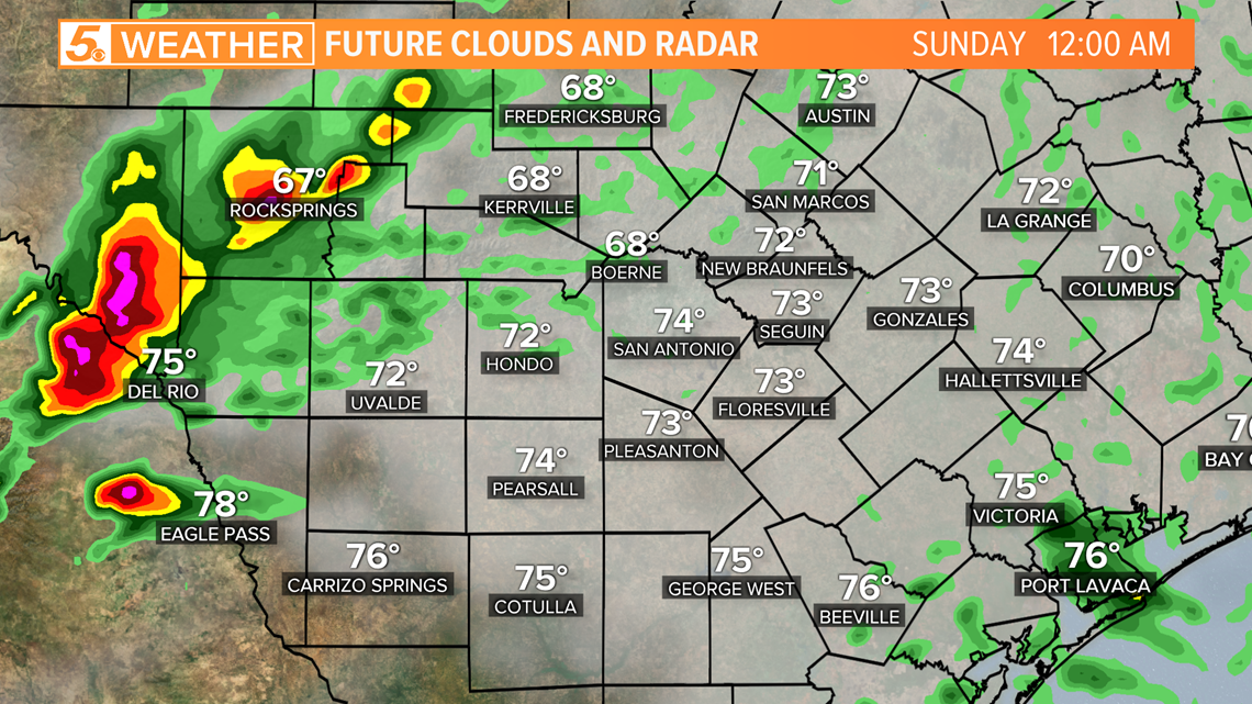
The timeline shows showers and storms starting to move into Val Verde County closer to midnight.

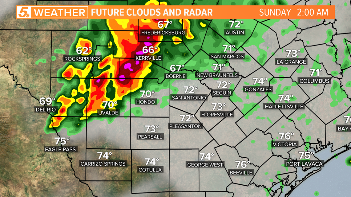
Storms will continue east through the Hill Country as we move throughout the morning and will get closer to Kerrville around 2 a.m.

At 4 a.m., the storms are expected to be along the I-35 corridor, impacting Bexar County and the San Antonio area.

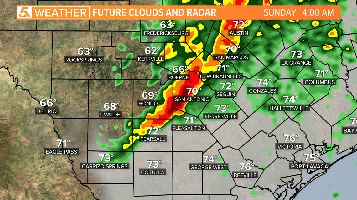
The line of strong to severe storms will be just east of the I-35 corridor by 5:30 a.m.

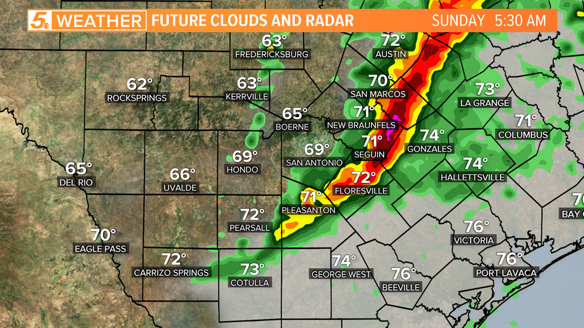
Showers and storms will start to move out of South Texas by 7:30 a.m. with a bit of lingering cloud cover behind the storms.

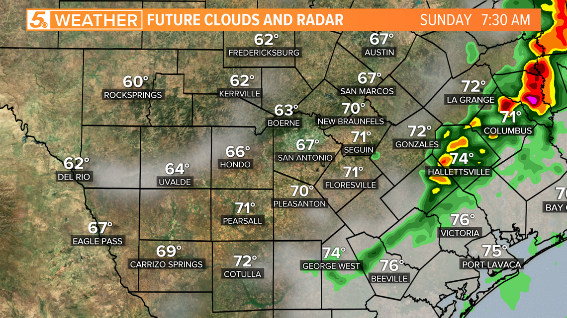
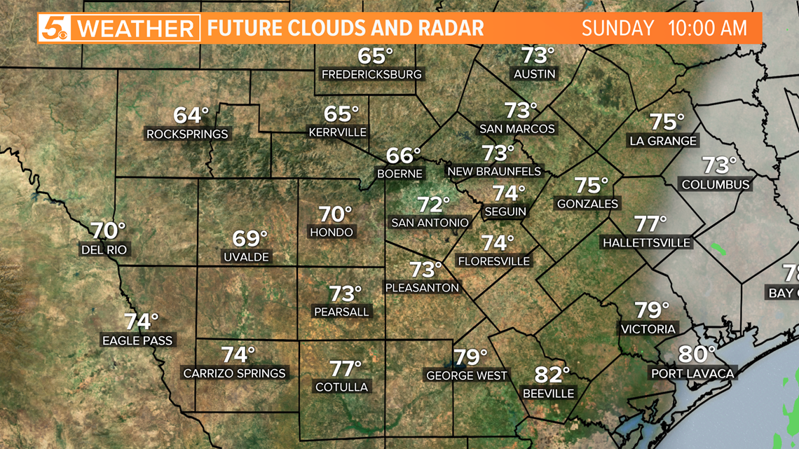
By 10 a.m., rain chances will drop from South Texas with a mostly clear sky left behind and temperatures expected to rise into the 80s during the afternoon hours on Easter Sunday.

Please know that this timeline for storms could easily change depending on the timing of the system that is causing these storms to form.
The KENS 5 Weather Team will continue to update this article and keep you informed ahead of the event and while storms are moving through.
Share your weather pictures with us on Facebook here.
Don't forget you can download the KENS 5 app for the latest news and weather information each day while you are on the go.
PEOPLE ARE ALSO READING:

