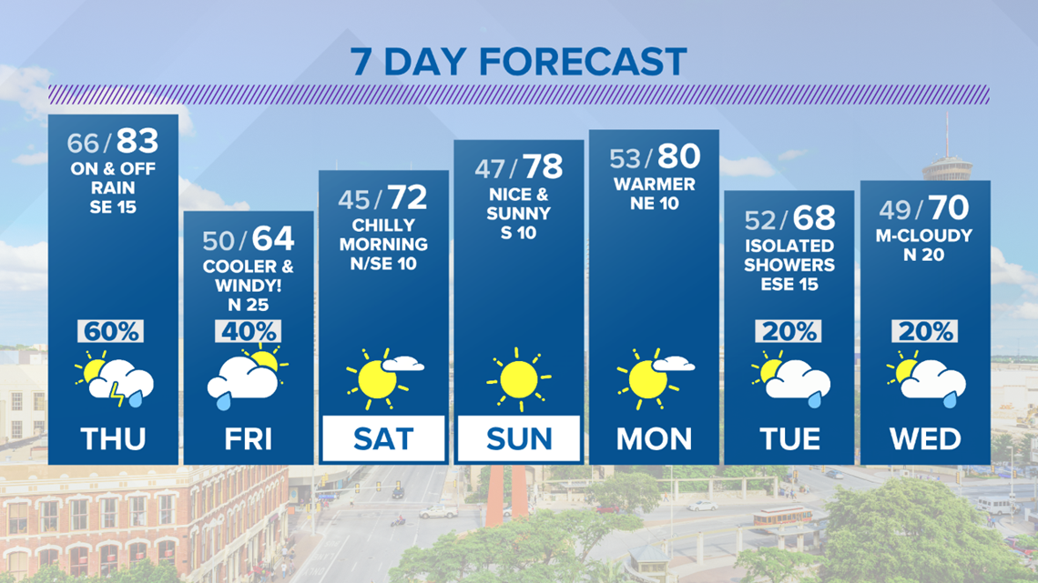
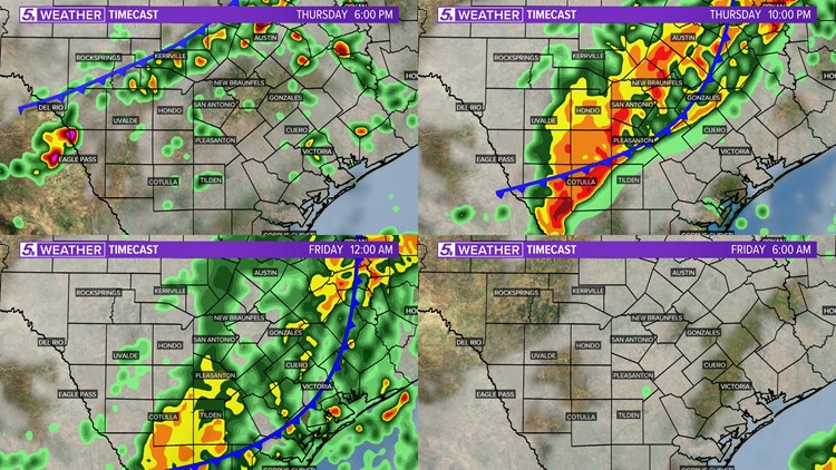
SAN ANTONIO — Our next round of wet weather will move in Thursday afternoon and evening. Strong to severe thunderstorms are possible tomorrow with Bexar and surrounding counties under a level one "Marginal Risk".

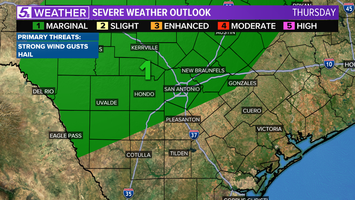
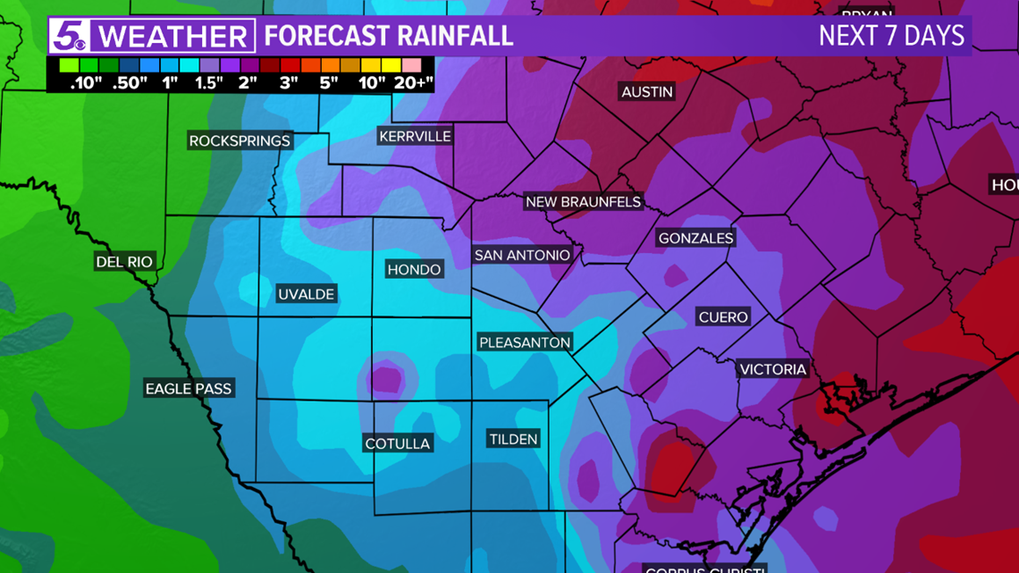
Severe thunderstorms may produce strong wind gusts, hail, and flash flooding is possible in flood-prone areas. Most of us will receive one to two inches of rain with isolated amounts up to four inches possible.

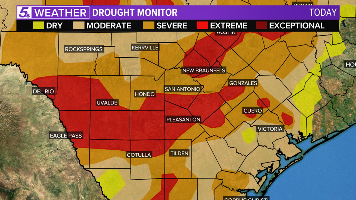
We need rain! Drought continues to worsen with our monthly rainfall well below-normal. Extreme drought takes over southern Bexar County and southern counties.

Noisy thunderstorms will likely move in after 7:00 p.m. Thursday, but scattered thunderstorms may fire up well ahead of the cold front. The thunderstorms that pop-up well ahead of the cold front could be strong or severe.
Heavy rain should move from northwest to southeast and linger into Friday morning.


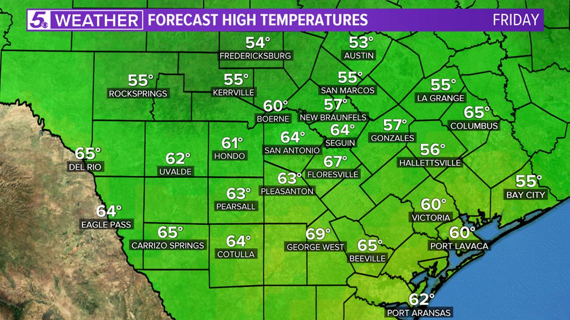
Temperatures will fall into the low to mid-60s Friday afternoon! Much cooler and windy with wind gusts up to 25 mph. May 10th was the last time our high temperature was below seventy degrees!

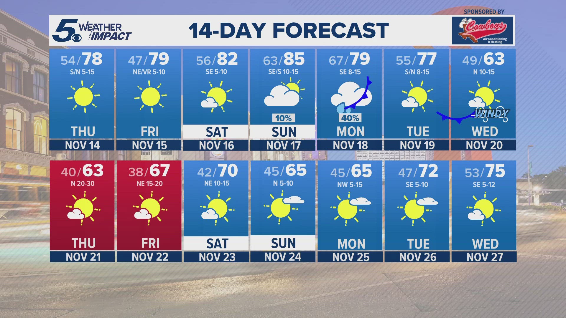
This weekend will be a nice one with lots of sunshine and fall-like high temperatures.

