SAN ANTONIO — Hurricane season is less than a month away and on this edition of 'Cloudy with a Chance of Learning' we talked about hurricane structure and what steers the storms.
The structure of a hurricane can tell us a lot about the health of the storm.
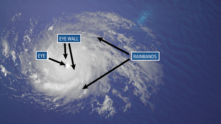
If a storm is strong and healthy, it will often have a well-defined eye.
Other features that hurricanes have can be seen from satellite imagery.
A strong storm will also have an eye wall and rainbands that extend far out from the center of the storm.


While the strongest winds in the storm are typically found in the eye wall, it is quiet within the eye, which is where sinking air can be found.
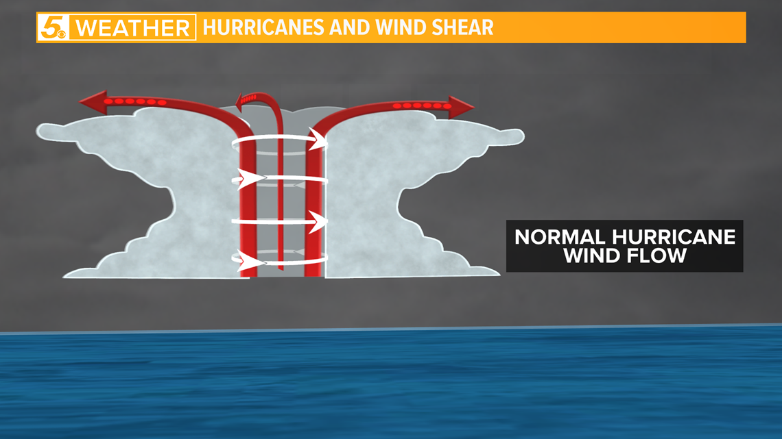
A hurricane with good structure will have a well defined eye and can be found in an area with low vertical wind sheer.
At the surface, air will rush into the center, go up the edges of the eye wall and then flow to the outer edge of the storm after reaching the top.

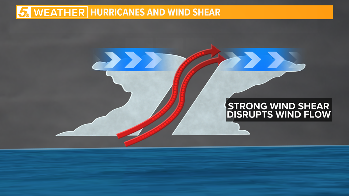
If a storm experiences strong sheer it could get ripped apart by the stronger wind, or it could lean over.

When it comes to steering these storms, other systems nearby can guide them in different directions.
RELATED:
For instance, if an area of high pressure is off to the east of a storm, it can cause it to move north.

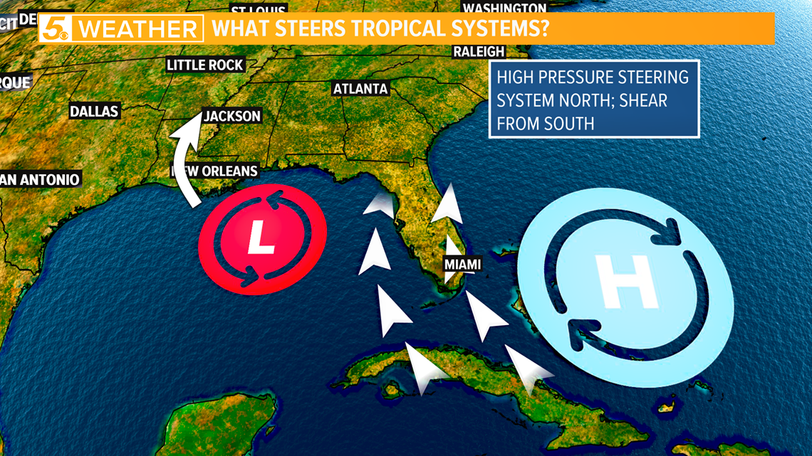
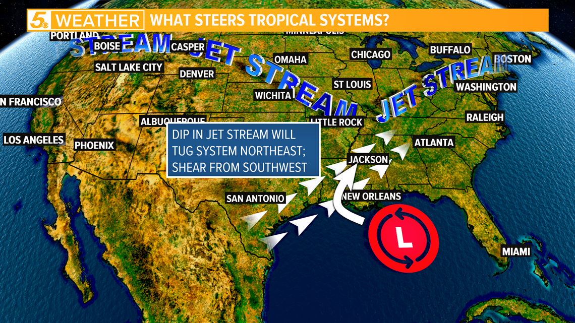
A dip in the jet stream can also help steer tropical systems.
Even if the jet stream is well off to the north, a dip in the jet stream, or what we call a trough, can pull the storm to the north and carry it away.

With hurricane season so close, it is important to have a hurricane action plan in place.
On next week's Tropical Tuesday segment of 'Cloudy with a Chance of Learning' we will talk more about preparing for hurricane season.
Don't forget you can download the KENS 5 app for the latest news and weather information each day while you are on the go.
PEOPLE ARE ALSO READING:

