SAN ANTONIO — Get ready, San Antonians, for some of the coldest temperatures we've seen this winter season. A strong arctic front is preparing to push through our area Wednesday afternoon, dropping temperatures for the end of the week.
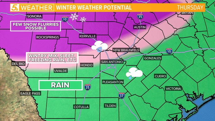
This arctic front will start as rain, bringing possible isolated storms, before a huge near-40-degree swing while rain potentially turns into to a wintry mix by Friday. This cold air mass will hang around through the weekend, bringing the chance for hard freezes overnight and wind chill values in the teens.
Here's what you need to know for the next five days
Wednesday (High 67 and Low 55): Fog is possible in the morning thanks to plenty of moisture ahead of the front. Showers will also occur as the front moves through San Antonio by late afternoon into the early evening.

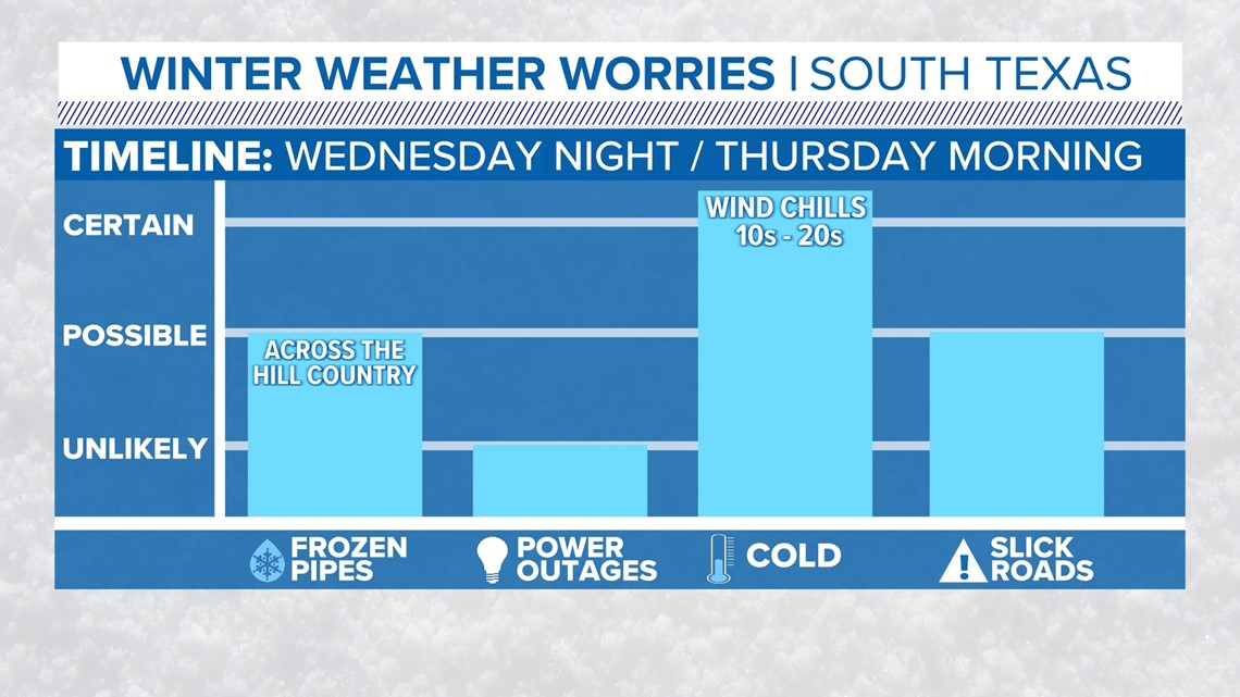
Winds - By late evening, around 9 p.m., winds will be gusting around 25 mph. Temperatures will drop into the upper-40s by midnight allowing wind chill values or "feels-like" temperatures to fall in the 20s.
Hazards - On Wednesday San Antonians' main concern will be slick roads. There could be some isolated thunder heard overnight bringing about .5 inches of rainfall for those isolated areas.
Thursday (High 38 and Low 35): San Antonians will wake up to temperatures in the upper-30s and continuing to drop throughout the day, allowing for freezing rain/sleet to form until the front passes through the area early evening. A few snow flurries are likely for the Hill Country.

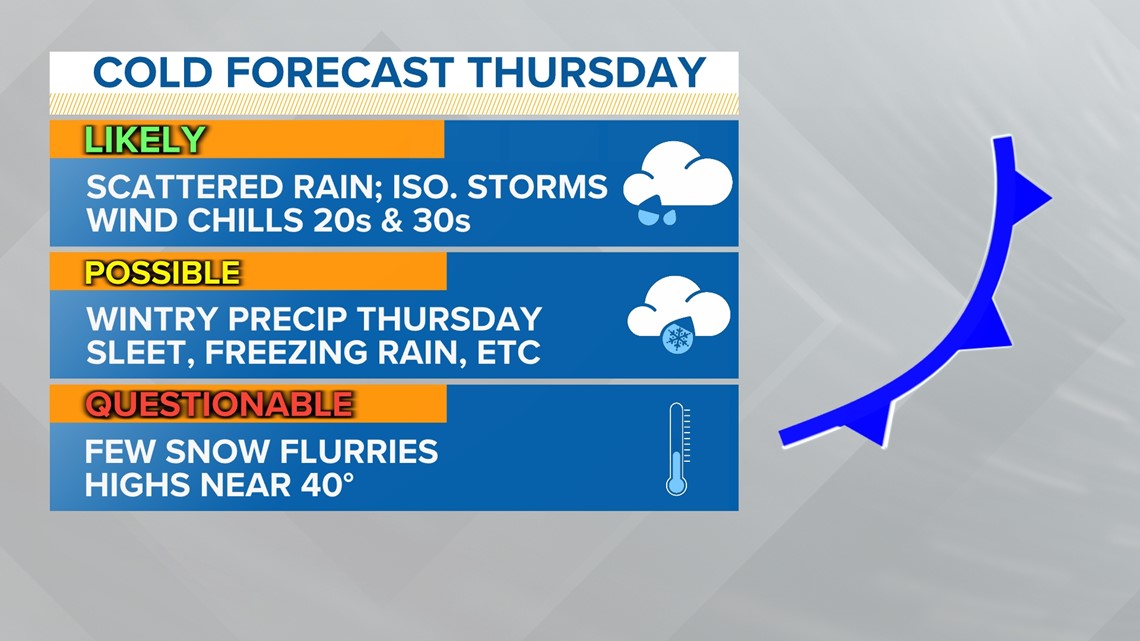
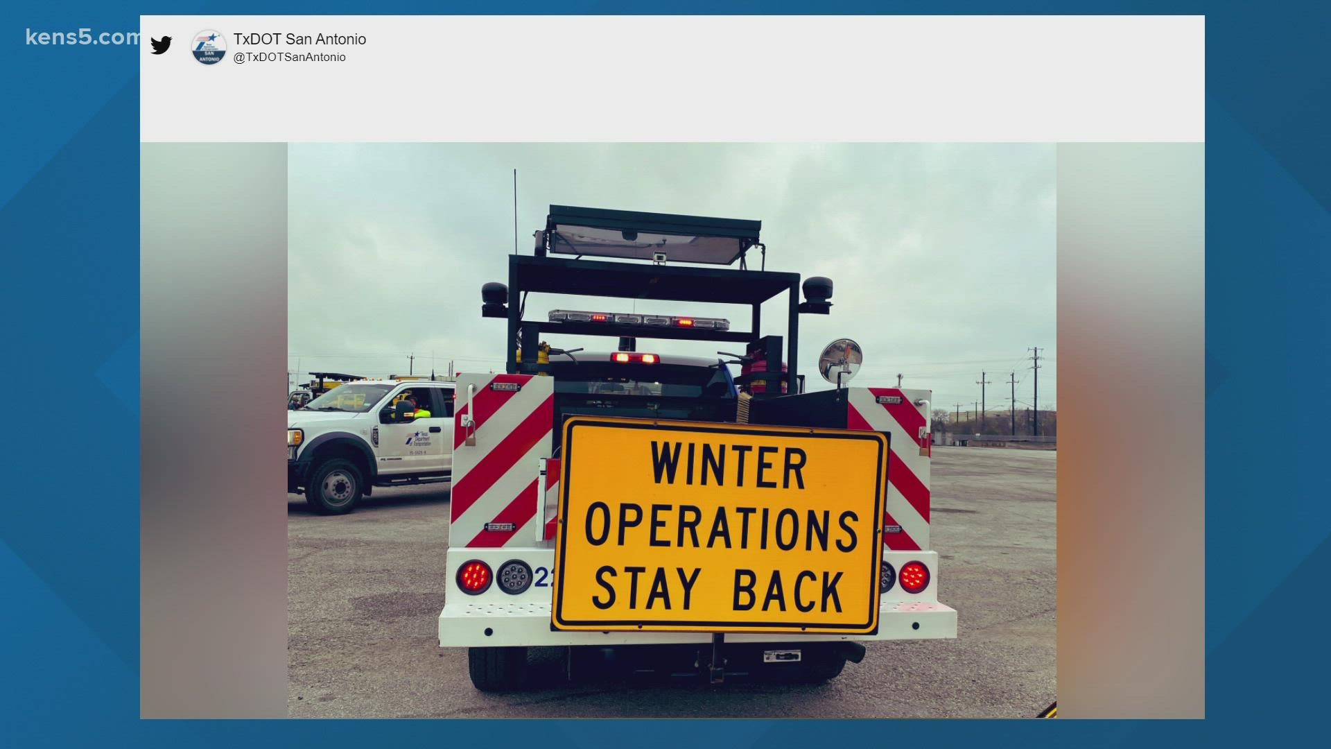
Hazards - Ice accumulation is possible on bridges and overpasses, producing slick driving conditions. A hard freeze is also possible Thursday night as temperatures will reach freezing conditions dropping into the 20s overnight.
Friday (High 35 and Low 22): You'll want to stay inside on Friday as temperatures start in the low-20s with winds gusting around 20 mph. This will produce the "feels-like" temperatures to be around 11 degrees. Brrrr...!

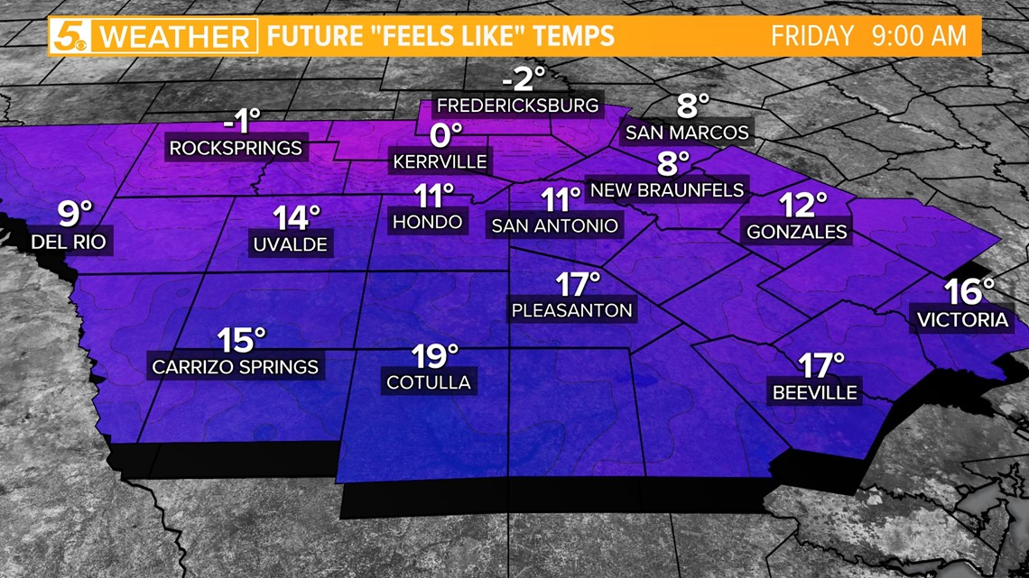
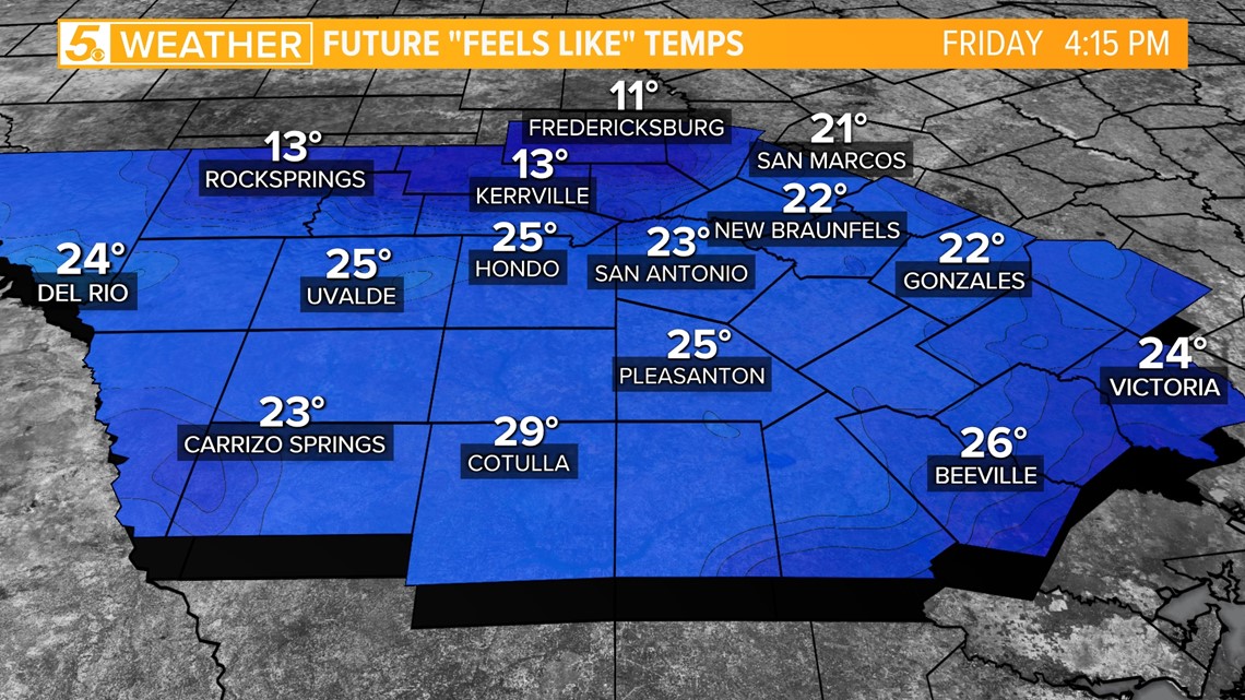
By the afternoon winds will continue to blow with "feels-like" temperatures staying low in the 20s. Therefore, another hard freeze is possible on Friday night.
Hazards - A risk for hypothermia exists for those spending an extended amount of time outside while not dressed in layers. So make sure to bring out those hats, scarves and gloves.

Weekend: After Friday and Saturday morning, the coldest temperatures should be behind us. Saturday morning will still be in the 20s but warming close to 40 degrees by the afternoon.
Sunday morning temps will still be in the 20s but then warming to near 50 degrees by the afternoon.
Precipitation: Models are still in disagreement on Saturday night as another system moves close to our region. If any precipitation does occur San Antonio could be in for another chance at a wintry mix.
This forecast is still in the developing stages and we'll fine-tune this forecast as it gets closer.


