
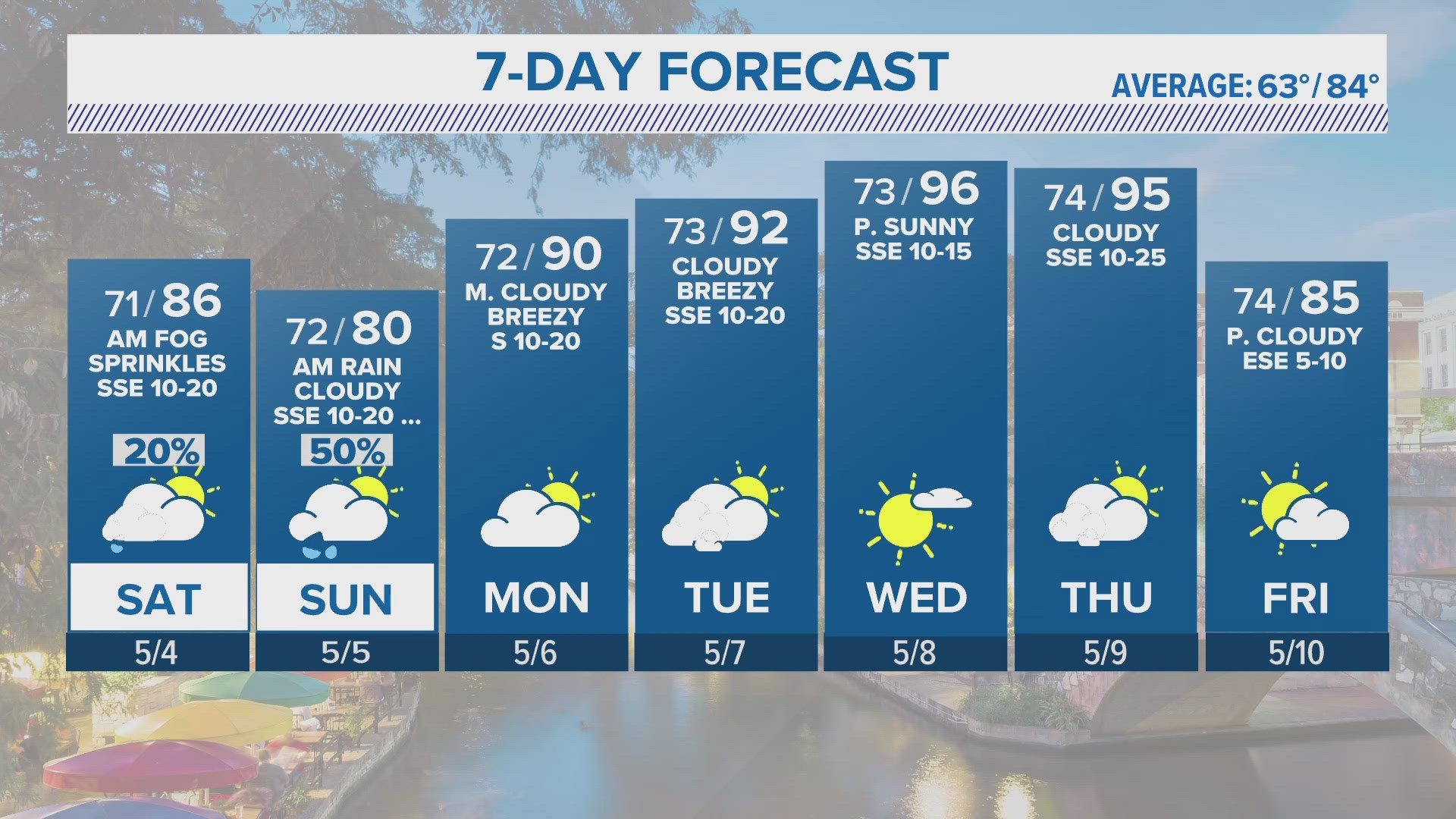
SAN ANTONIO — Saturday we’ll start with sprinkles and patchy fog before pushing out around 10 a.m. It’ll be mostly cloudy with highs in the mid- 80s and winds from the Southeast around 5 to 10 mph.
We’re under a marginal risk for severe thunderstorms late Saturday afternoon and night. There is an increased risk for severe storms if you’re traveling to the hill country and further west. Damaging winds, isolated flooding, and large hail will be the main threats with this disturbance. Any new rain should total around less than .10, but higher amounts are definitely possible for us in thunderstorms.
Sunday will start very soggy with a chance for showers and storms in the early morning hours. It will then turn mostly cloudy again with highs in the low 80s. Winds will be Southeast around 10 to 15 mph.
Monday morning will be cloudy and rain chances diminish. This is when highs will start to climb into the upper 80s and by Tuesday, we'll be in the mid 90s with sunshine making a nice appearance.
Wednesday and Thursday look to be the warmest days this week before our next front arrives on Thursday. Temperatures will take a slight dive back into the 80s for Friday.
Pollen count
- Molds, 8,120, Heavy
You can download the KENS 5 app in the App Store or Google Play. Also be sure to follow KENS 5 on Facebook, YouTube, Twitter and Instagram for updates on the weather.
Follow the KENS 5 Weather Team on social media: