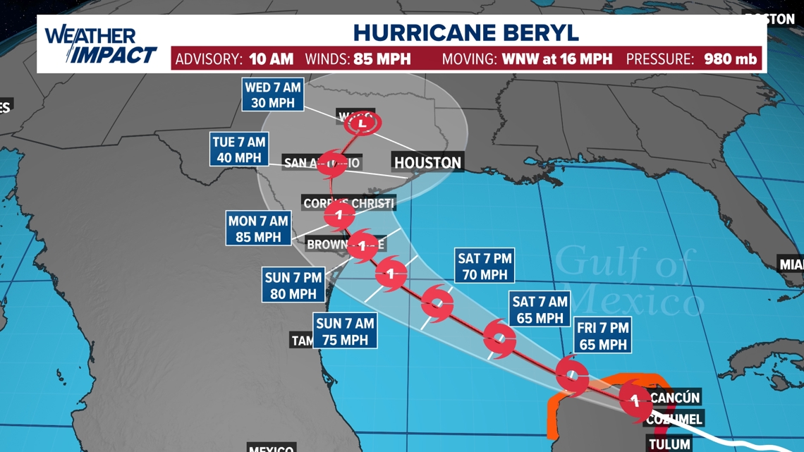
HOUSTON — Tropical Storm Beryl is moving through the Yucatan Peninsula and is forecasted to weaken into a tropical storm before reemerging over open water toward the South Texas/north Mexico coast.
Beryl's latest forecast track has shifted slightly north, skirting along the Texas coast, potentially making direct impacts to Corpus Christi.


Editor's note: This story was originally published the afternoon of July 4. You can see the latest updates on this page.
No matter the location of landfall, it is important to note that distant hurricanes can be deadly. We will see impacts from Beryl here in Southeast Texas even though landfall will likely be many miles south of us.
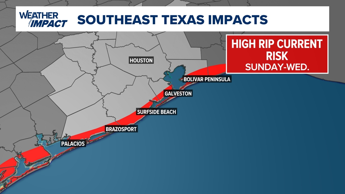
When hurricanes and tropical storms enter the Gulf of Mexico, the body of water acts like a bathtub, churning waters causing rough seas and high rip current risks hundreds of miles of away.


As we have seen fatalities within the past few months from high rip currents from Galveston to Surfside Beach, this hazard will return as Beryl edges into the Gulf of Mexico by the end of this upcoming weekend. If you are heading to the coast, it is important to stay out of the water if you see red flags. Never assume the ocean is safe, even if the water appears calm. Stay near lifeguards if you plan to spend time along the Gulf Coast.
RELATED: Models are in agreement on where Beryl will go the next couple days. That changes Saturday.
Also, coastal flooding is possible during high tide times. During high tide, expect less beach access. Once water recedes, beach erosion is possible, creating drop-off hazards and damage to structures along the beach.
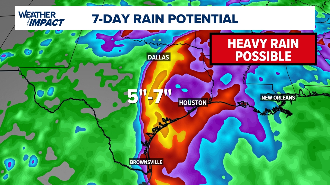
Rain chances will also increase across the southern half of Texas beginning late Sunday and lasting through Wednesday. It is too early to tell where the heavier rainfall will be next week, but weather models are suggesting that portions of Texas could receive 5"- 7" of rainfall through next Thursday.


