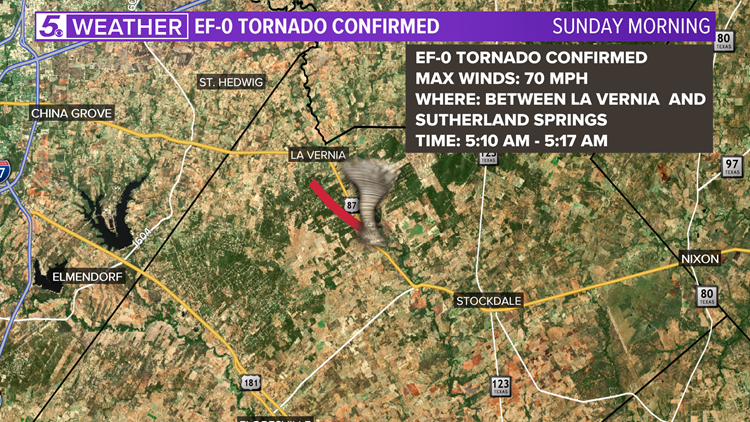
LA VERNIA, Texas — A small EF0 tornado touched down south of La Vernia early Sunday morning, the National Weather Service confirmed Monday.
According to preliminary damage survey results, the tornado touched down around 5:10 a.m. along Hwy 87, two miles north of Sutherland Springs. The National Weather Service estimates peak wind gusts reached 70 miles per hour. The storm had a max width of 20 yards and traveled 3.3 miles along the ground.
The majority of the damage was to trees and outbuildings. Power poles and lines were also damaged in a few locations. No one was injured during the seven-minute event.
Severe weather threatened South Texas throughout the weekend as Hurricane Hanna made landfall on Padre Island and moved across the area into Mexico. Portions of South Texas, including Duval and Jim Wells Counties were under a Tornado Warning Saturday evening.
NWS teams continue to survey South Texas for potential tornado damage and storm surge impacts.
Hanna weakened to a tropical storm Sunday and was labeled a tropical depression by Monday morning. While the storm continues to weaken, San Antonio and the South Texas area will still get a few showers and storms, but expect the amount of thunderstorm activity to be much lower for Monday with only a 40% chance for a few brief showers and storms as temperatures rise into the 90s for highs. The rain chances clearing up for a mostly-sunny Saturday to start the first weekend of August.
Get the last weather news straight to your phone. You can download it in the App Store or Google Play. Also be sure to follow KENS 5 on Facebook, YouTube, Twitter, and Instagram for updates on the weather.
Follow the KENS 5 Weather Team


