
SAN ANTONIO — The historical peak of hurricane season occurred on September 10, and the tropics are staying active as we move into the middle of the month with the eighth named storm of the season just north of the Bahamas.
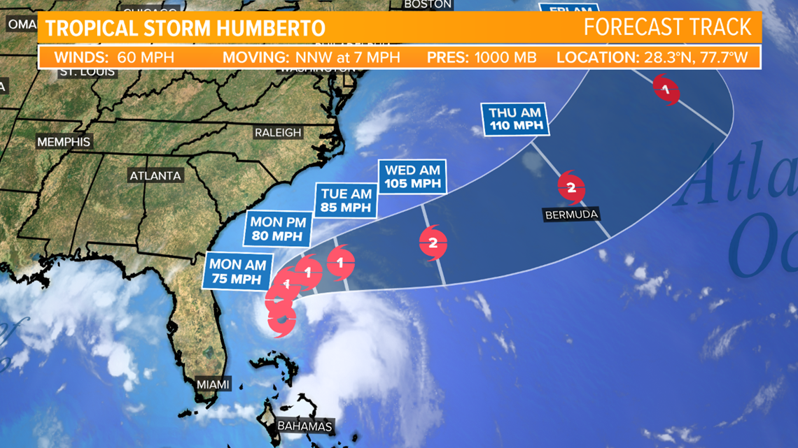
There are two waves highlighted by the National Hurricane Center as having a chance for development over the next five days and we have one developed system, Tropical Storm Humberto, which is currently just north of the Bahamas.
Tropical Storm Humberto is expected to curve away from the United States, possibly impacting Bermuda by the middle to end of next week.
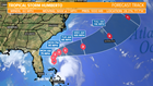
One other wave is located in the middle of the Atlantic Ocean and is expected to move toward the Lesser Antilles over the next five days. This system has a high chance of development over the next five days.

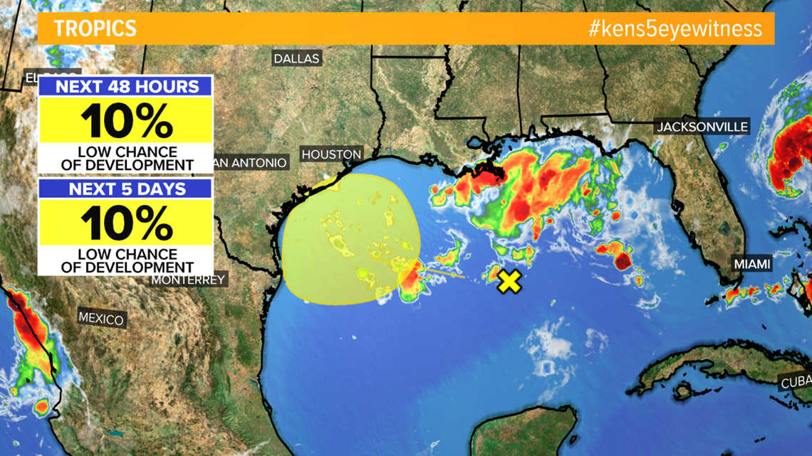
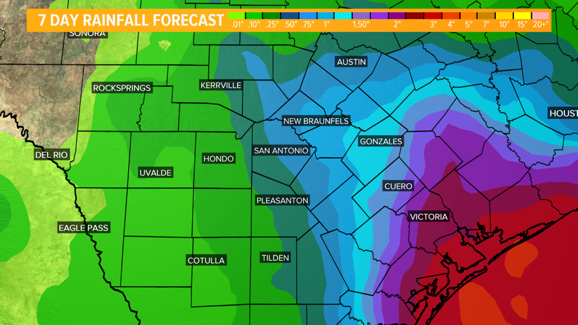
Finally, there is a low chance for development for a tropical wave in the Gulf of Mexico that is expected to move toward the Texas coast. This system has a 10% chance for development over the next five days as it moves west toward Texas. The only impacts from this system currently expected are heavy rainfall and breezy conditions for the coast.

RELATED:
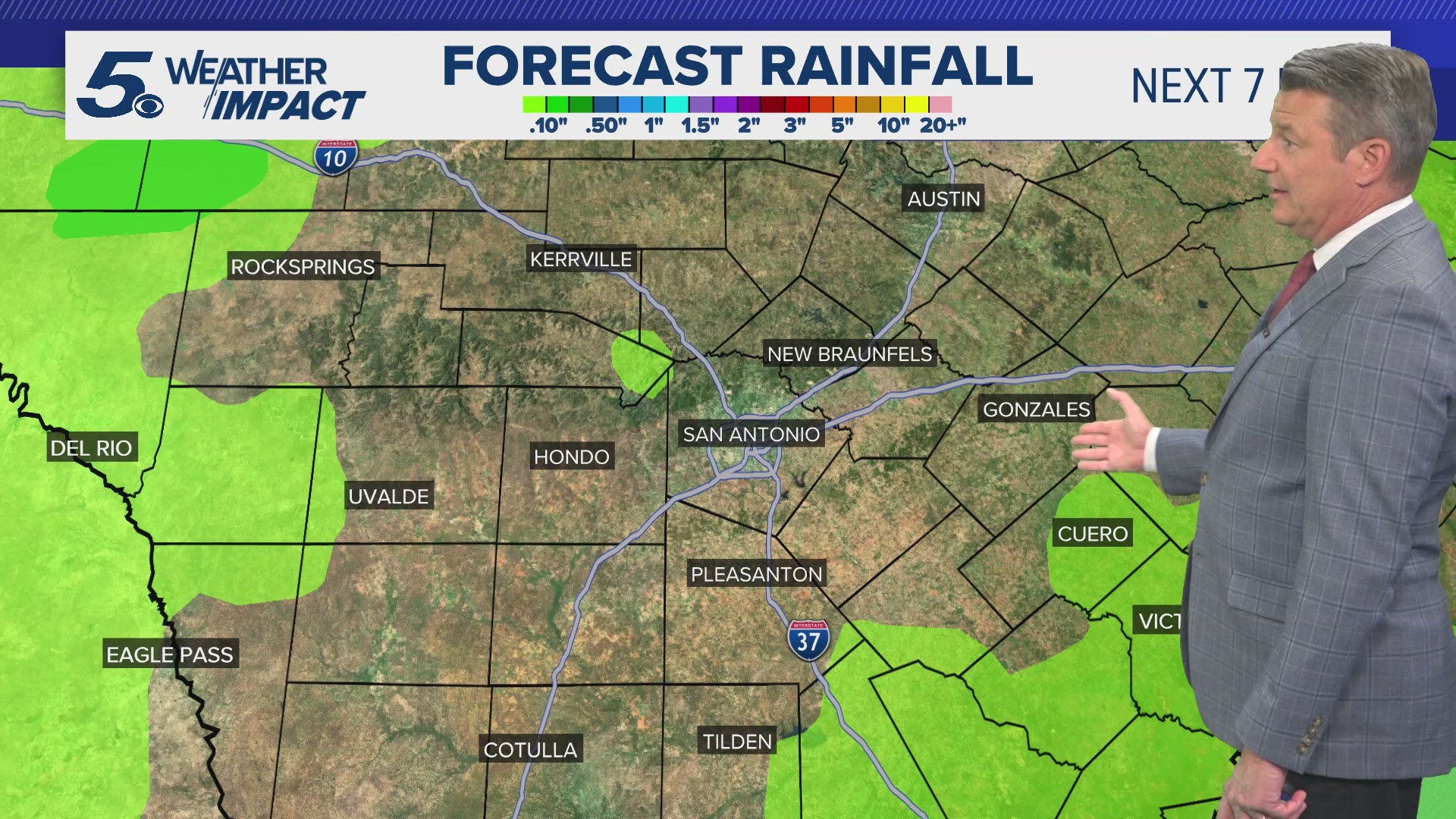
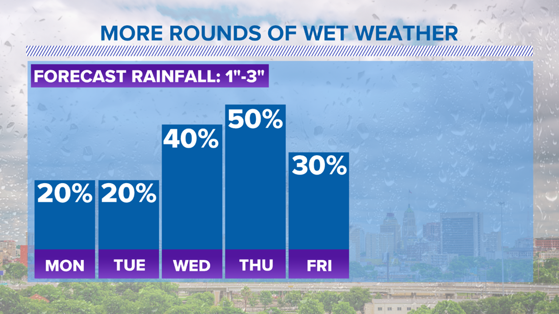
Some coastal areas of Texas could see up to five inches of rainfall over the next week from the system with isolated spots seeing more. Bexar and surrounding counties could see one to three inches of rain through Friday.

We will keep you updated on this system as more develops. Keep the KENS 5 mobile app in your back pocket next week to keep track of rain in your area at any time! Free radar and forecast updates are available at your fingertips.
PEOPLE ARE ALSO READING: