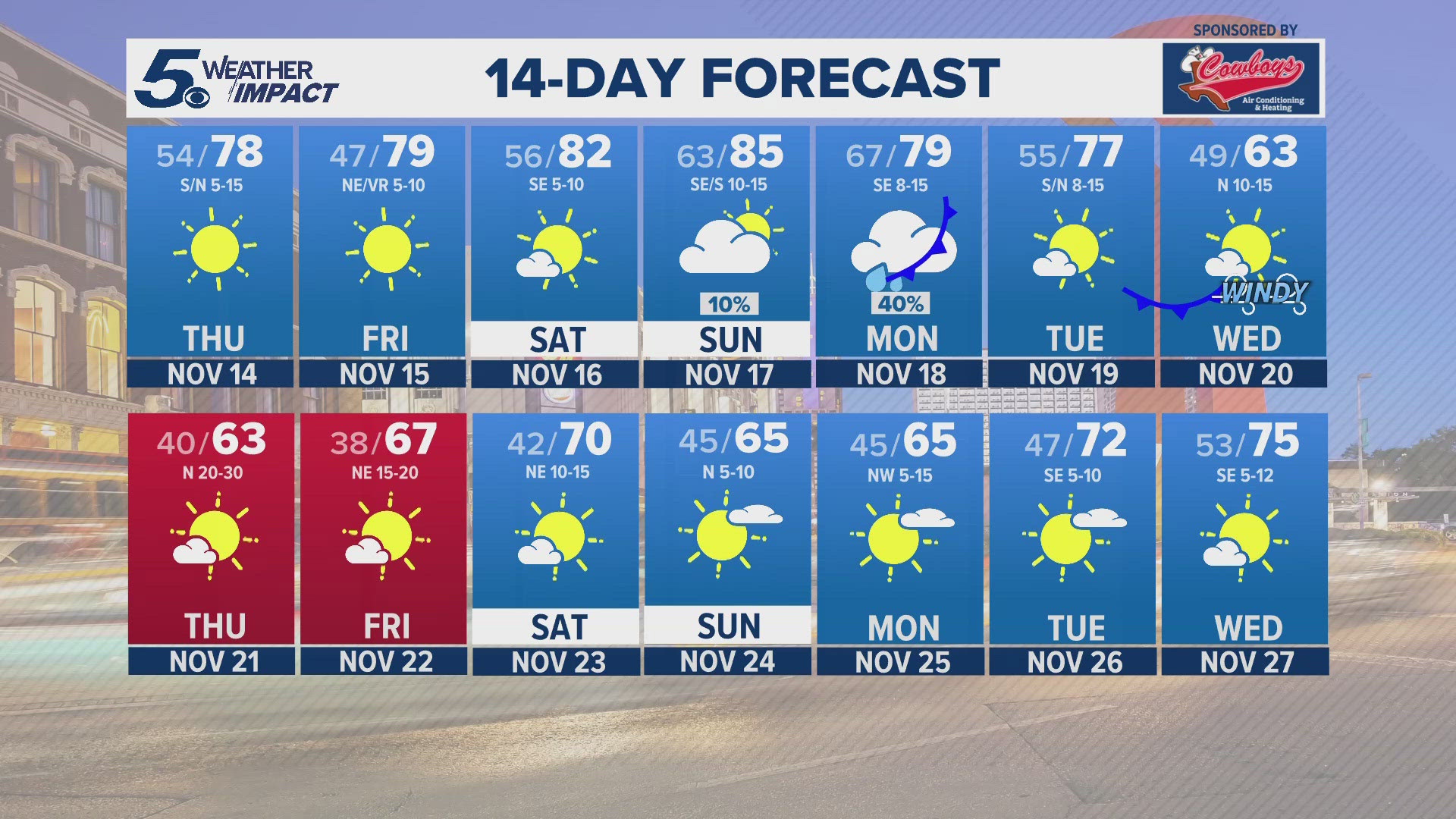
SAN ANTONIO — South Texas is currently under an unsettled weather pattern and will continue to be over the next few days. Showers and storms are expected to move through the region and bring anywhere from a half of an inch to an inch and a half of rain. Some isolated spots though may see up to three inches of rainfall through Wednesday morning.

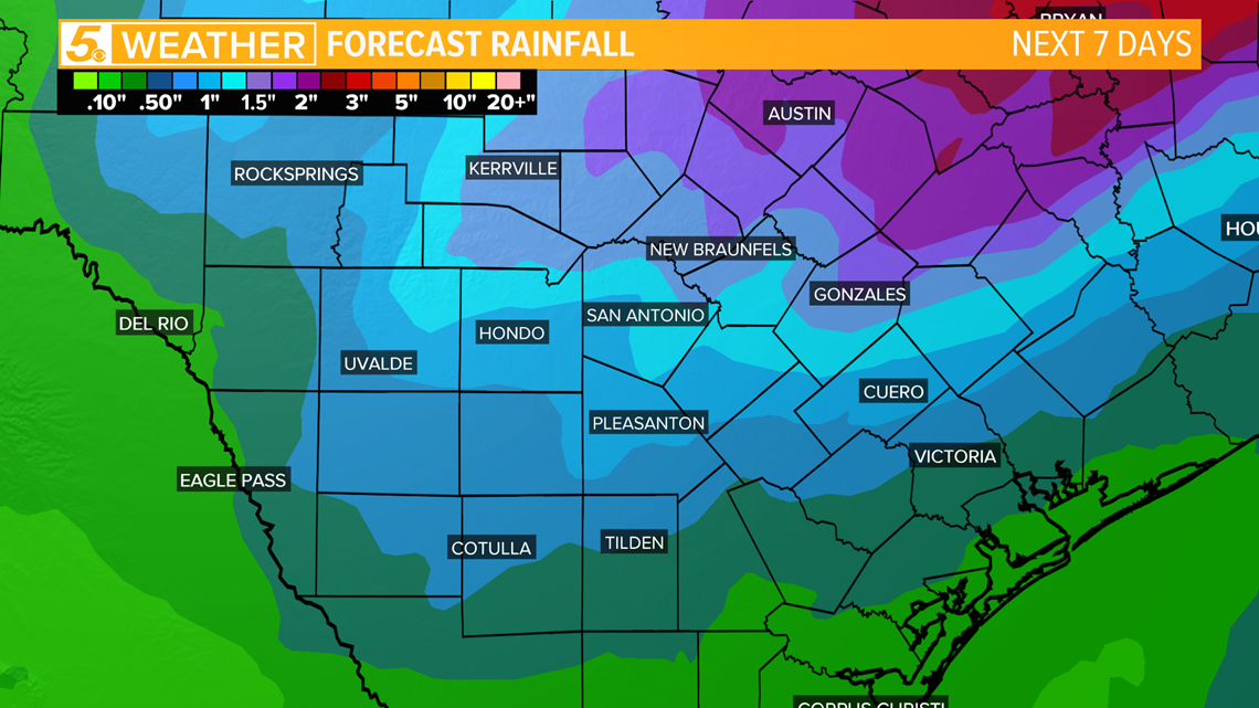
Our rain coverage has increased for today as a cold front is moving through. Stay weather aware this afternoon. Northern counties will have the ingredients in place to support isolated strong to severe thunderstorms.

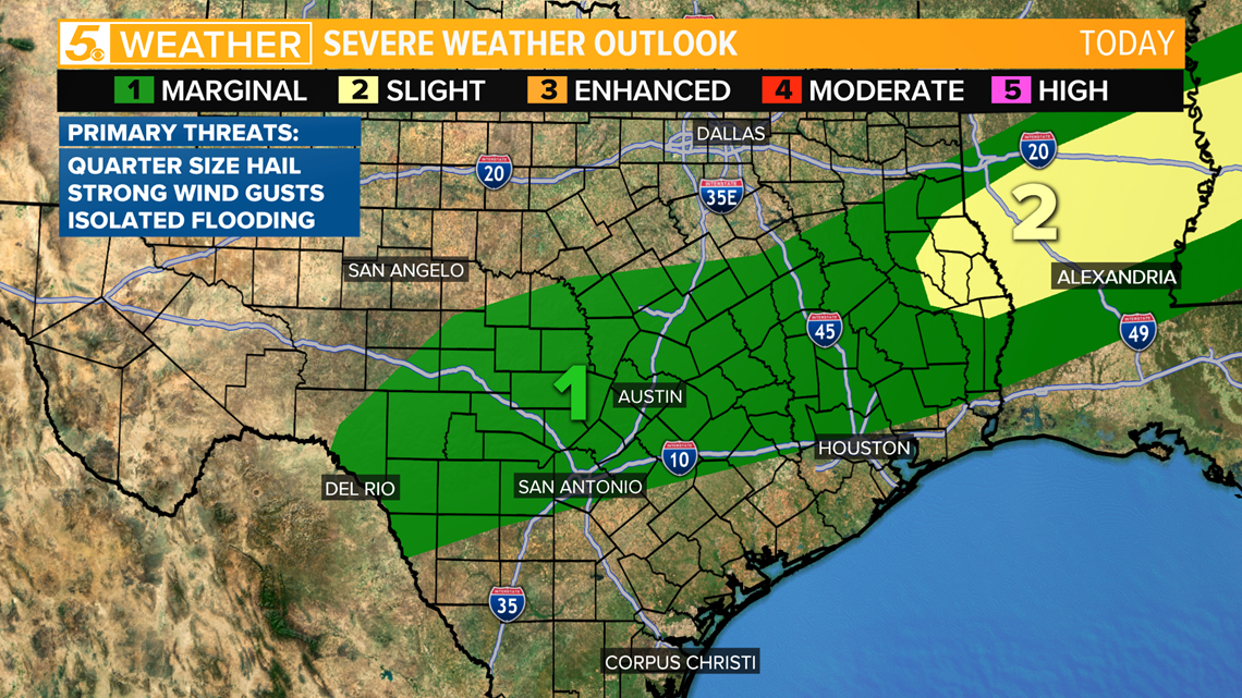
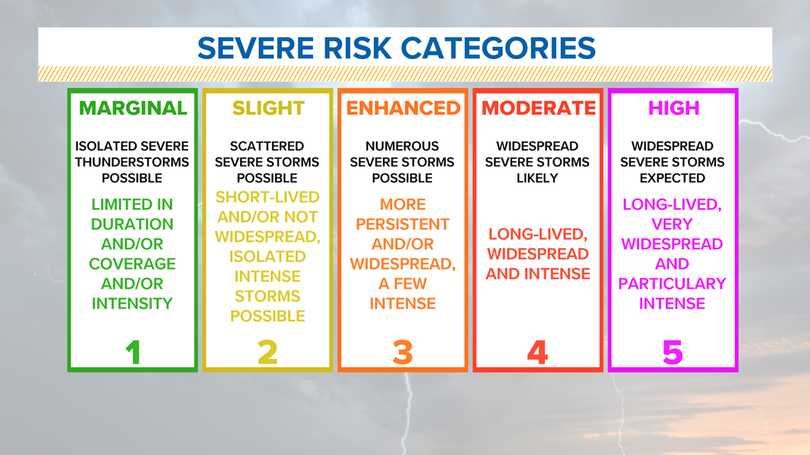
Bexar and northern counties are under a level 1 "Marginal Risk" for today. Strong thunderstorms may produce quarter size hail, strong wind gusts, and heavy rain may cause isolated flooding.

RELATED:
As the cold front moves southeast, temperatures will gradually fall into the low-60s and upper-50s during the day. Clouds will stick around with wind gusts up to 15 miles per hour possible.

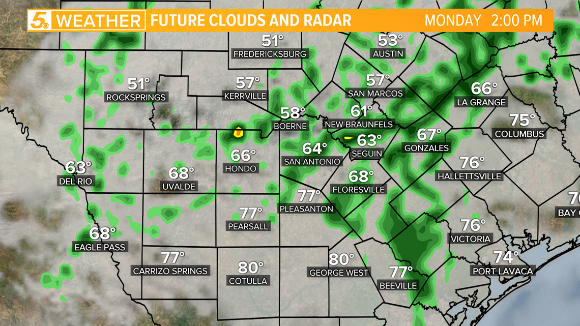
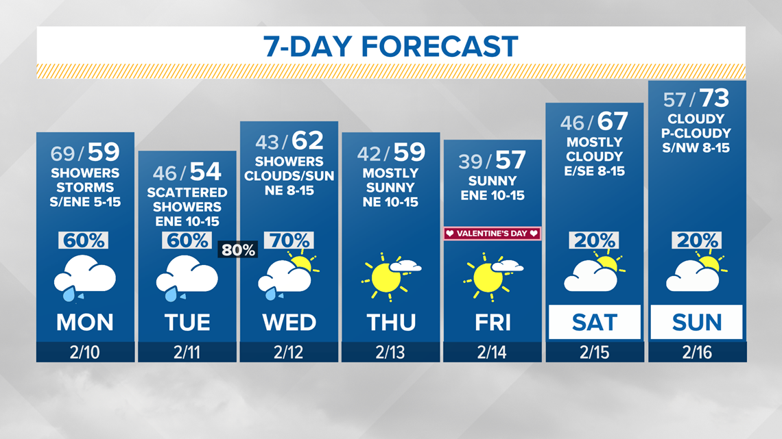
It will feel much cooler on Tuesday with high temperatures in the mid to upper-50s. We will see more rounds of wet weather as an upper-level disturbance moves over Texas early week.
Keep the umbrella handy! Numerous showers and non-severe thunderstorms are likely Tuesday through Wednesday morning.
Rain should begin to move east out of South Texas by Wednesday afternoon. Skies will continue to clear Wednesday night and we will see lots of sunshine on Thursday. It will stay dry, but cool on Valentine's Day.

Don't forget you can download the KENS 5 app for the latest news and weather information each day while you are on the go.
PEOPLE ARE ALSO READING:


